Bent Leg Blues and Catching Up (part 2)

Featured
(2024 Heartland Ep 2)

In recent years we have made several late-winter/early-spring camping trips to the Florida Keys. This year’s trip has some interesting surprises.

Robert is Here has an amazing selection of local and exotic fruits and vegetables

Robert is Here!

Fist-sized green Emu eggs would make a rather pricey omelet!

Our Florida Keys journey began with a stop at Robert is Here, an amazing fruit stand near Homestead at the start of the Keys. Dozens of local and exotic fruits and vegetables, and amazing fresh fruit-flavored milkshakes, can be purchased.  

The attraction was named for a sign Robert’s dad made to get the attention of people passing by his six-year-old son’s small fruit stand in 1959.  That day all of his produce was sold by noon and Robert’s lifelong fruit stand business was born!   

On to the Keys and John Pennekamp State Park 

From Florida City on the Florida mainland to its end in Key West, the Overseas Highway counts down 126 miles.  There’s lots to see and do all along the drive!

Our first stop was at mile marker 102.5 near Key Largo to spend a week at John Pennekamp Coral Reef State Park.  The park is known for coral reefs located several miles off the ocean side of the island.  Excursion boats carry snorkelers who view the coral and various sea life, and scuba divers who swim to a well-known underwater statue of Christ. 

Underwater statue of Christ at John Pennekamp SP (from Fla State Park website)

Due to choppy sea conditions, we opted for a glass bottom boat tour.  Unfortunately, the reefs were seriously damaged by high water temperatures last summer (as high as 101.1 F) and the reef views were disappointing.  One can only hope the reefs will recover with more normal ocean temperatures.

We did enjoy bicycling and hiking several short trails in the park and nearby.  A highlight of our visit was kayaking some very interesting ‘water trails’ in the park mangroves.

Pat kayaking in the mangrove canals at John Pennekamp SP

Crocs, Gators and More in the Everglades

We took two day trips to Everglades National Park.  At the northern boundary of the park, we bicycled the 15-mile Shark Valley loop road, passing herons, egrets and numerous alligators. The highlight of the ride was a viewing tower from which we could see expansive grasslands and hammocks.  The tower reminded us of a similar structure at Clingman’s Dome in Great Smoky Mountains National Park.

Viewing tower at Shark Valley in Everglades NP

Shark valley views – biking, birds and trailside gators

The next day we drove to Flamingo, a developed area deep in the heart of the national park.  They have an excellent visitor center, campground, other accommodations and marina. 

Snarly-toothed crocodile at Flamingo

At the marina boat landing, a park ranger kept curious visitors at a safe distance from two large snarly-toothed crocodiles that were sunning themselves.  We learned the Everglades has crocodiles AND alligators – both are rather ominous!  Meanwhile, several manatees swam at boat docks not too far away.

We hiked along an overgrown canal to Florida Bay; the tall white feathered fellow blocked the path

Later, we hiked along an overgrown canal trail to a viewpoint of the Florida Bay.  We saw many birds, including one rather tall white egret that blocked the trail for a bit, and a number of stealthy alligators trying to hide nearby.

Elevation 3 feet – the Everglades are flat!

As we exited the park that afternoon, we stopped at Rock Reef Pass, elevation 3 foot.  The Everglades are remarkably flat, indeed!

We tried a cinnamon bun at Doc’s Diner in Key Largo – it was 4+ (out of 5) sweet goodness

On to Bahia Honda State Park

Bahia Honda sunset seen from the campground

From Pennekamp SP we continued on the Overseas Highway past the busy towns of Islamorada and Marathon, and across the seven-mile bridge to Bahia Honda State Park, mile marker 37.8.  The park is one of our favorite places to camp.

We bicycled to see the remains of a railroad bridge built by Henry Flagler.  The railroad to Key West was an amazing engineering feat for its time.  Completed in 1912, trains made the trip for 23 years before the bridges and rail lines were seriously damaged by the Labor Day Hurricane of 1935.   The railway was turned over to the state and converted to an automobile highway in the following years.

There are beaches on both sides of the island – an oceanside beach faces the Strait of Florida and Cuba, and a gulf-side beach faces Florida Bay and distant Everglades.  There are places to camp on both sides of the island.

Construction workers and supplies were staged on Pigeon Key during construction of the 7 Mile railroad bridge

Pigeon Key – A Tiny Island with a Big Story

One day we visited Pigeon Key, a small island visible from the seven-mile bridge.  We took a tram nearly three miles on the original Bahia Honda bridge to the island that was used as a work camp when the original railroad bridge was built.  Photos and relics in Pigeon Key buildings give an interesting history about the railroad.

Ouch! Pap has a bent leg

Pap Gets A Bent Leg

We have been blessed with relatively few issues with our vehicles and campers as we have traveled over the years. 

We had an unfortunate accident when arriving at Bahia Honda.  As we entered the campground, the front camper jack hit a post that protected the campground entry keypad. The jack, used to raise the camper, was significantly bent.   Pap had to stay on Percy until we got home and the jack was replaced.  It was an unfortunate and expensive lesson.          

Next Week 

Our heartland journey begins as we travel to Huntsville, TX for a week at Camp Cedarbrook Texas.

Badland Raves and Mammoth Cave

Featured
(2023 Alaska Revisited Ep 29)

Our trip home included visits to two national parks.

Theodore Roosevelt National Park

After the death of his wife and mother on Valentine’s Day 1884, Teddy Roosevelt sought solitude and healing in the North Dakota Badlands.    The rugged landscape and strenuous life that he experienced there helped shape the conservation policy we benefit from today.

The rugged badlands at Theodore Roosevelt National Park in North Dakota

His ranch and two nearby areas are now part of Theodore Roosevelt National Park. 

The Little Missouri River winds through the park

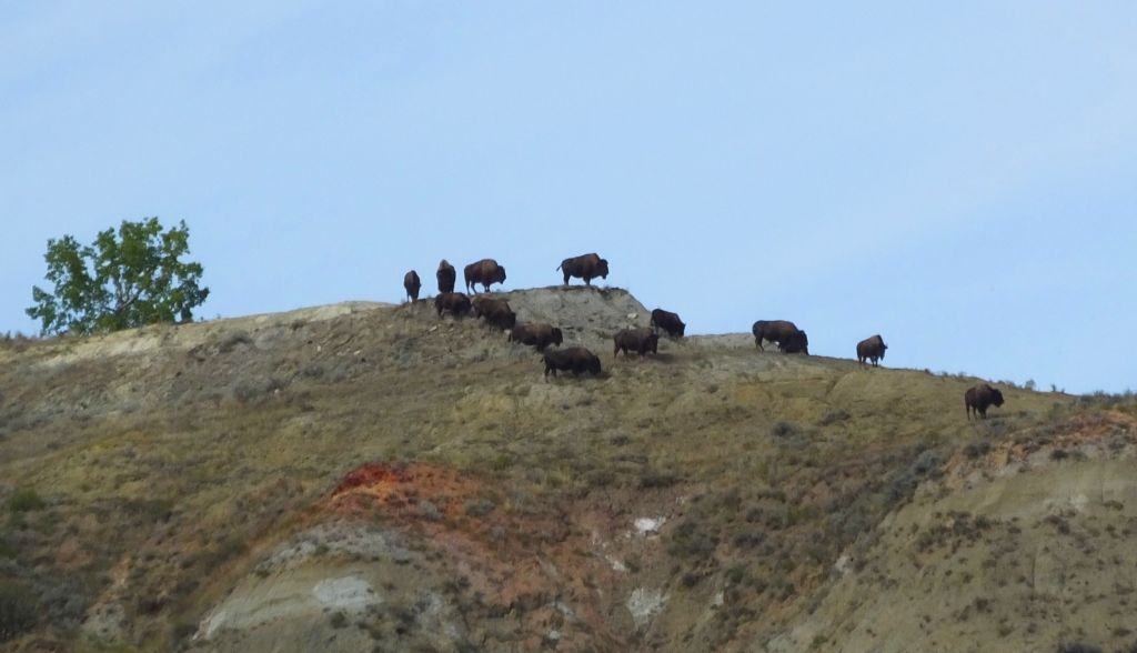
We spent three days in the park and marveled at the weathered landscape and the Little Missouri River that winds through the park.  Two scenic drives provided plenty of viewing opportunities of deep, layered canyons that cut into the grassed prairie and a wide variety of Great Plains wildlife, including bison, pronghorn antelope, elk, bighorn sheep and wild horses. 

God owns bison on a thousand hills… (Psalm 50:10 paraphrase)
This brute eyed us from atop a drop-off. We kept our distance!

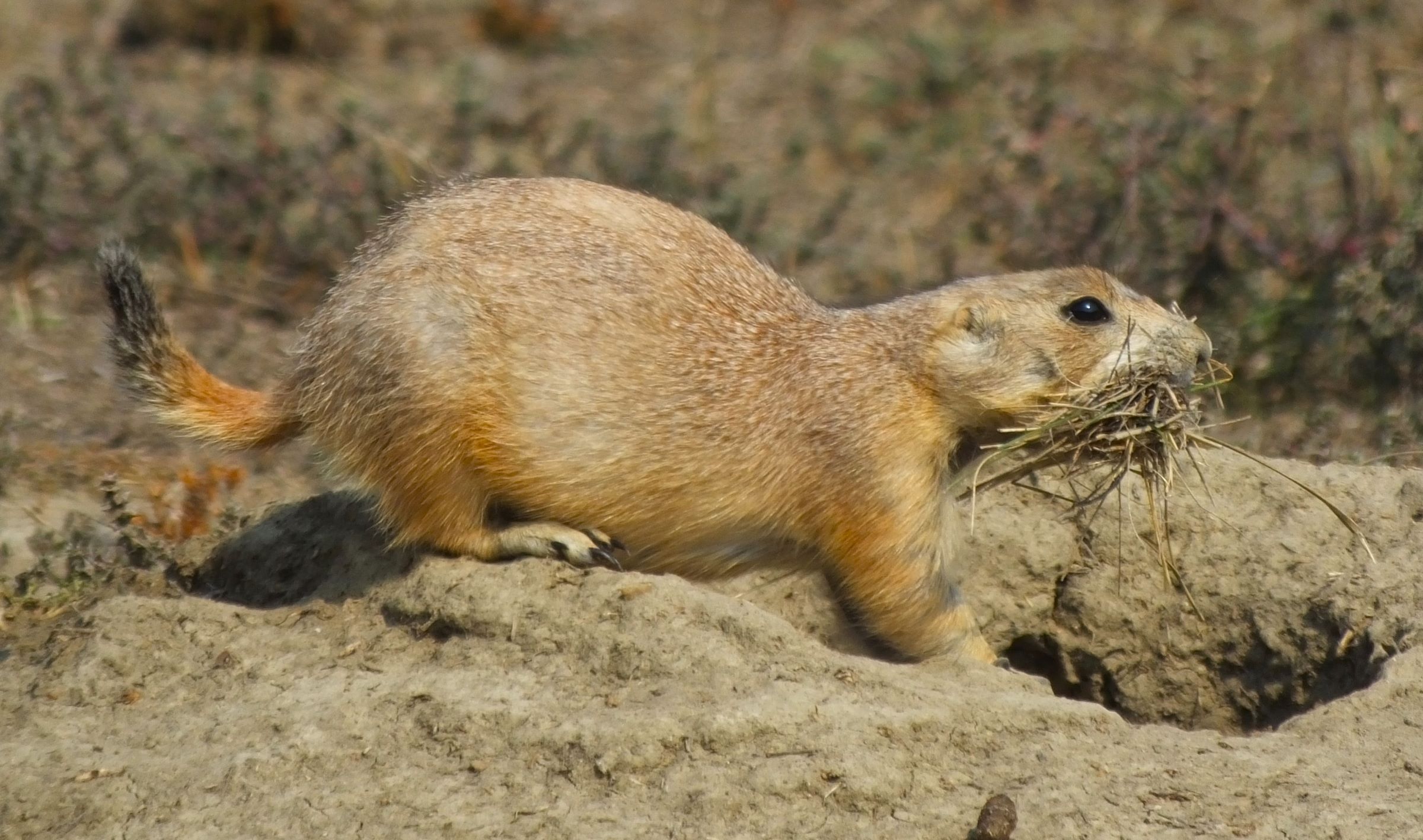
We hiked two miles along a small canyon to hard packed bottom land.  The trail passed small dirt piles with a few prairie dogs scurrying about.  We were at the prairie dog suburbs. 

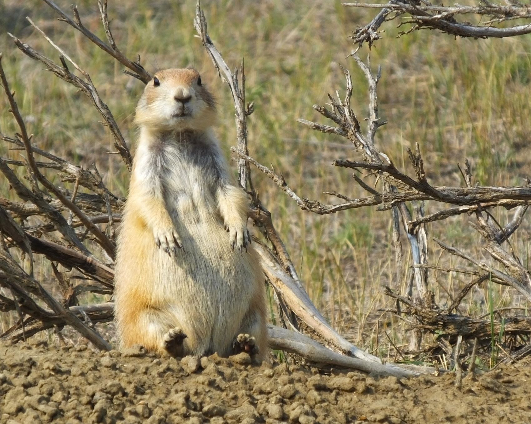
Ahead, we came to many, many more dirt piles and hundreds of the yapping terrier-sized critters that announced our arrival.  Some scurried in and out of holes, and others sat or sprawled lazily, watching us closely.  This was TRNP’s prairie dog city!

Citizens of TRNP prairie dog city

Later we saw a number of unusual cannonball-shaped rocks along the base of an eroded canyon wall.  These were spherical concretions formed by mineral deposits dripping through gaps in the sediment.

Unusual cannonballs jut out of the eroded hillsides, some more than four foot in diameter

A Close Encounter of the Bison Kind

We saw telltale evidence of bison throughout the park.  Individuals and small groups wandered up and down the hills and valleys, including one group of nearly a dozen bison that walked in the middle of one of the scenic drives. Several passed within feet of our truck!

Several bison walked on the road right by our truck

Our mid-September visit to TRNP was enjoyable: the scenic drives and trails weren’t crowded, campsites were available in the park and the weather was pleasant.  If you pass through North Dakota on Interstate 94, the park is a great stop.

We visited the monument of the Lakota Indian holy man and leader Sitting Bull. It is located on a remote bluff above the Missouri River near Mobridge, South Dakota.

From TRNP, we continued south, visiting many of the roadside attractions mentioned recently in RabbiTRAILS episode 27 and episode 28.

Mammoth Cave National Park

Closer to home, we visited Mammoth Cave National Park in south-central Kentucky.  Explorers have surveyed and mapped 426 miles of the cave, making it the world’s longest known cave system.

Our last visit to the cave was in 1991, when we took several ranger-guided cave tours with Liz and Phil, our (now) adult children.  32 years later, our tours included the Extended Historic Modified Tour and Violet City Lantern Tour.

Percy and Pap would easily fit in some Mammoth Cave passages
Something to ponder: when does graffiti become a historic artifact?
Mammoth Cave’s bottomless pit is actually 105 feet deep

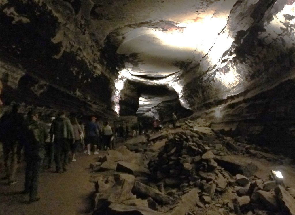
We hiked a steep trail down to the cave entrance where we entered the cool cave and walked nearly two underground miles on the two-hour Extended Historic Modified Tour.  The tour included many of the historic areas that originally made the cave famous – visits to huge rooms that gave Mammoth Cave its name and much tighter places deep inside the cave. We endured the narrow passage through fat man’s misery and welcomed the underground restrooms in great relief hall that followed.  The tour also included a side trip to the site of the 1840s Mammoth Cave experiment to treat consumption.

Getting ready for the big squeeze on the way to great relief hall

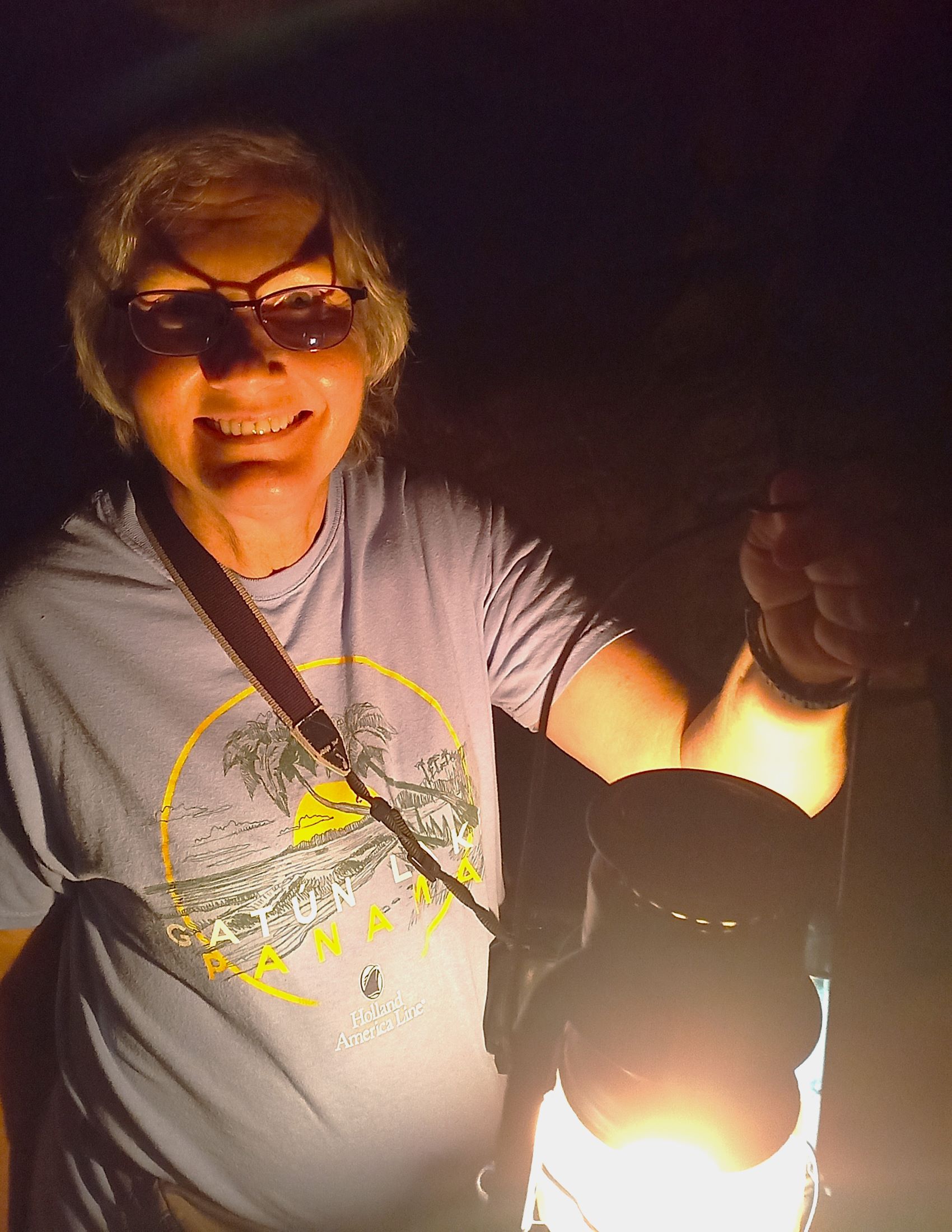
The next morning’s Violet City Lantern Tour was exclusively by lantern light.  For nearly three hours, we followed the dimly lit three-mile trail as it wound through huge, broad tunnels. We climbed and descended several steep hills on our way to the cave exit. The exit was several miles from the original cave entrance and a bus took us back to the visitor center

The three-hour tour was illuminated with kerosene lanterns

Mammoth Cave has few flowstone formations typically seen in caves. The formations above are at Wondering Woods Cave, a separate cave a few miles from the main cave
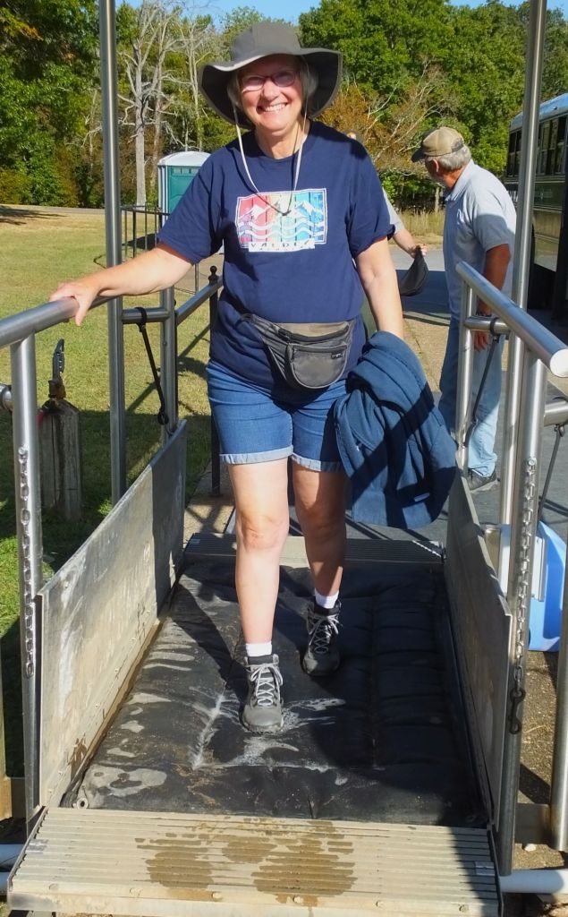
Pat walks the mat to save a bat. At the end of each cave tour, we walked across a bio-security mat that kills fungus spores that cause white-nose syndrome fatal to cave bats

Mammoth Cave tours are moderately strenuous. Some of the trails include series of stairs and a few steep climbs.  The rangers do a great job providing interesting historical and geologic details.  Before visiting, we recommend researching the cave tours and buying tickets in advance, as many tours sell out during the busier late-spring and summer months.

Critter Count

bison – many
pronghorn antelope – 36
wild turkey – 11
deer – 16
wild horses – 20
sandhill cranes – 2
prairie dogs – many
snakes – 3
skunk – at least 1 (by the smell)

Next week

We wrap up our 2023 Alaska Revisited trip with a by-the-numbers recap. Pat and I will compare our answers to several questions that include best trip experiences, favorite places camped and most amazing views. 

And we will reveal our pick of the best cinnamon bun of the trip!

Elk Calls and Waterfalls (and more) in the Canadian Rockies

Featured
(2023 Alaska Revisited Ep 26)

Canada’s Banff and Jasper National Parks are a common stopover for those driving to or from Alaska.  After nearly two months in Alaska and several weeks in Yukon and Northwest Territories, we decided to check out these parks as we headed home.

The parks encompass the Canadian Rockies, with Jasper NP (and the town of Jasper) to the north and Banff NP (and town of Banff) to the south.   The 143-mile Icefields Parkway, one of the world’s most scenic highways, connects the two parks.

Getting There

From Dawson Creek and the end of the Alaska Highway, we drove southeast past large wheat and hay fields at first, then across rolling hills with dense forests, and finally through low mountains.  We expected to see rugged and tall mountains along the route, but thick forest fire smoke kept them mostly hidden.

The mountains were shrouded in rain and smoke when we arrived at Jasper NP
Jasper National Park

It was drizzling when we arrived at Jasper NP and set up camp.  Near freezing nighttime temps with snow flurries were forecast, so we splurged on a campsite with electricity and water.  That night, we were thankful for the tiny electric heater that kept us warm.

We were awakened by the eerie bugle calls of nearby elk the next morning.  We couldn’t see them but knew they were there!  We opened Pap’s window shades and were elated to see sunshine and the tall mountains surrounding the campground.

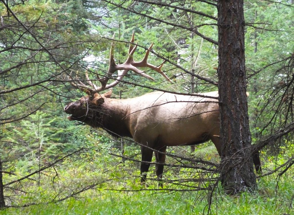
A magnificent elk bugles during our trail encounter
An Elk Encounter of the Jasper Kind

After breakfast, we hiked a short trail around Annette Lake. We stopped to watch an elk rubbing its huge antlers against a small tree.  The tree shook back and forth, no match for the big animal.  The elk eyed us warily, so we made plans to take cover in a thick stand of trees nearby should the elk came toward us.  Fortunately, he walked away from us toward the lake and emitted a shrill bugle call, as if to warn us not to follow! 

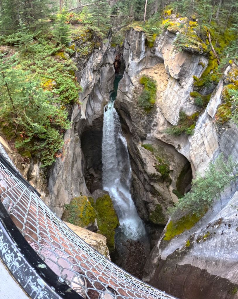
Narrow Maligne Canyon with a small creek nearly 100 foot below
The Maligne Canyon widens as side creeks join the main flow

Later that day we took a longer and muddier hike along the Maligne Canyon, where a small creek flows through a deep fissure in the rocks.  We crossed several bridges as the trail followed the creek downstream. Other creeks joined the flow and we were soon following a swiftly flowing river.

We had dinner in Jasper, a town similar to Gatlinburg, TN and Estes Park, CO.  The streets and businesses weren’t busy. We were told the busy summer tourist season had ended a few days earlier.

Icefields Parkway     

The next day we started south on the Icefields Parkway.  

Turbulent Athabasca Falls

Our first stop was at Athabasca Falls, a beautiful and powerful waterfall that cascades 75 feet through narrow rock outcroppings on the Athabasca River.  The river starts at the toe of the Athabasca Glacier and eventually to the Arctic Ocean via the Mackenzie River.

Athabasca Glacier
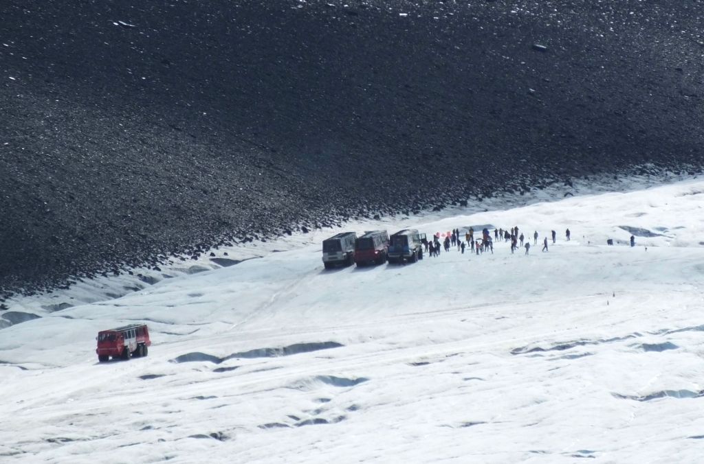
Snow coaches and visitors on the Athabasca Glacier

A few miles south we stopped at the Columbia Icefield Discovery Centre.  To the west we could see the Athabasca Glacier extending downward from the Columbia Icefield.   The icefield is the largest in North America’s Rocky Mountains.  Big-wheeled snow coaches were taking visitors up a steep road for a short walk on the glacier (a neat experience we enjoyed in September 2014).  

Banff National Park

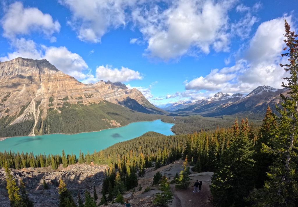
The next day, we continued along the parkway and stopped mid-morning to hike up a steep 1.5-mile trail to Peyto Lake Viewpoint.  At the end of the trail, we stepped onto a crowded platform for a magnificent view of turquoise Peyto Lake far below framed by the rugged mountains.

A view of Peyto Lake and the Canadian Rockies

Our drive ended in the town of Banff, where we enjoyed touring the town during our two-night stay in the area.  Parking in the area is very crowded and expensive, so we purchased day passes for public buses that go to most of the local points of interest.  It was nice not to drive for a couple of days!    

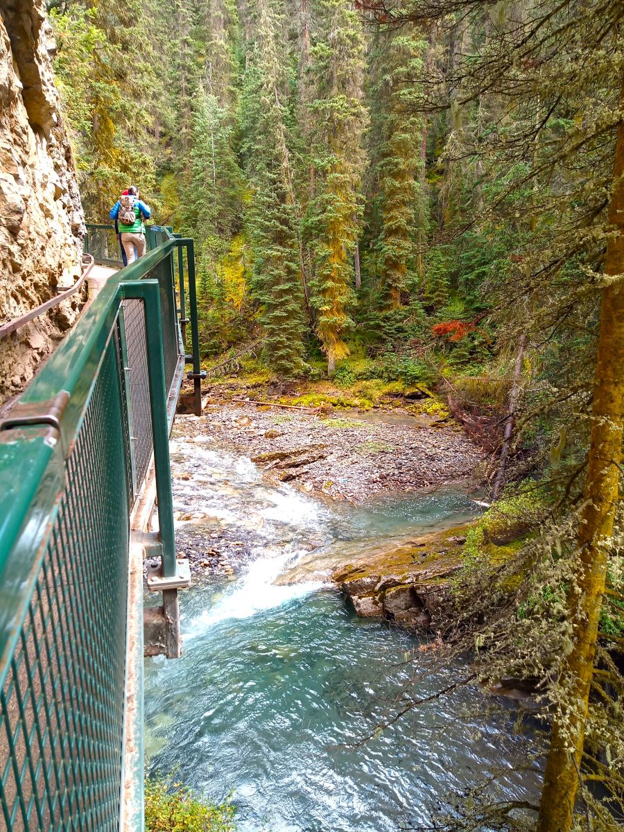
Suspended walkway in Johnston Canyon and Lower Johnston Falls

We hiked along narrow suspended walkways to Johnston Lower Falls and later visited a nice waterfall on the Bow River very close to the town of Banff.  The Bow River flows from the Columbia Icefield/Athabasca Glacier as it makes its way to the Columbia River and Pacific Ocean.

Banff is a very walkable town, with much of the downtown area closed to auto traffic

(You may find it interesting that rivers originating from the Columbia Icefield flow into the Atlantic, Pacific and Arctic oceans! Besides the two rivers mentioned above, a third, the Saskatchewan River, eventually reaches the Atlantic Ocean via Lake Winnipeg and Hudson Bay)

Banff is Canada’s first national park.  Combined with Jasper and other national parks in the Canadian Rockies, they offer amazing opportunities to see beautiful mountains and rivers, and abundant wildlife.

Like Yellowstone NP in the US, many persons visit the parks and roads/parking lots/trails/viewpoints are often crowded, even during the mid-September ‘shoulder’ season when we visited.   We recommend advance planning and making reservations for the best experience!

Our four-day visit was not sufficient to see all Banff and Jasper parks have to offer.  We hope to visit the area again in the future.

Critter Count

Deer – 5
Elk – 23
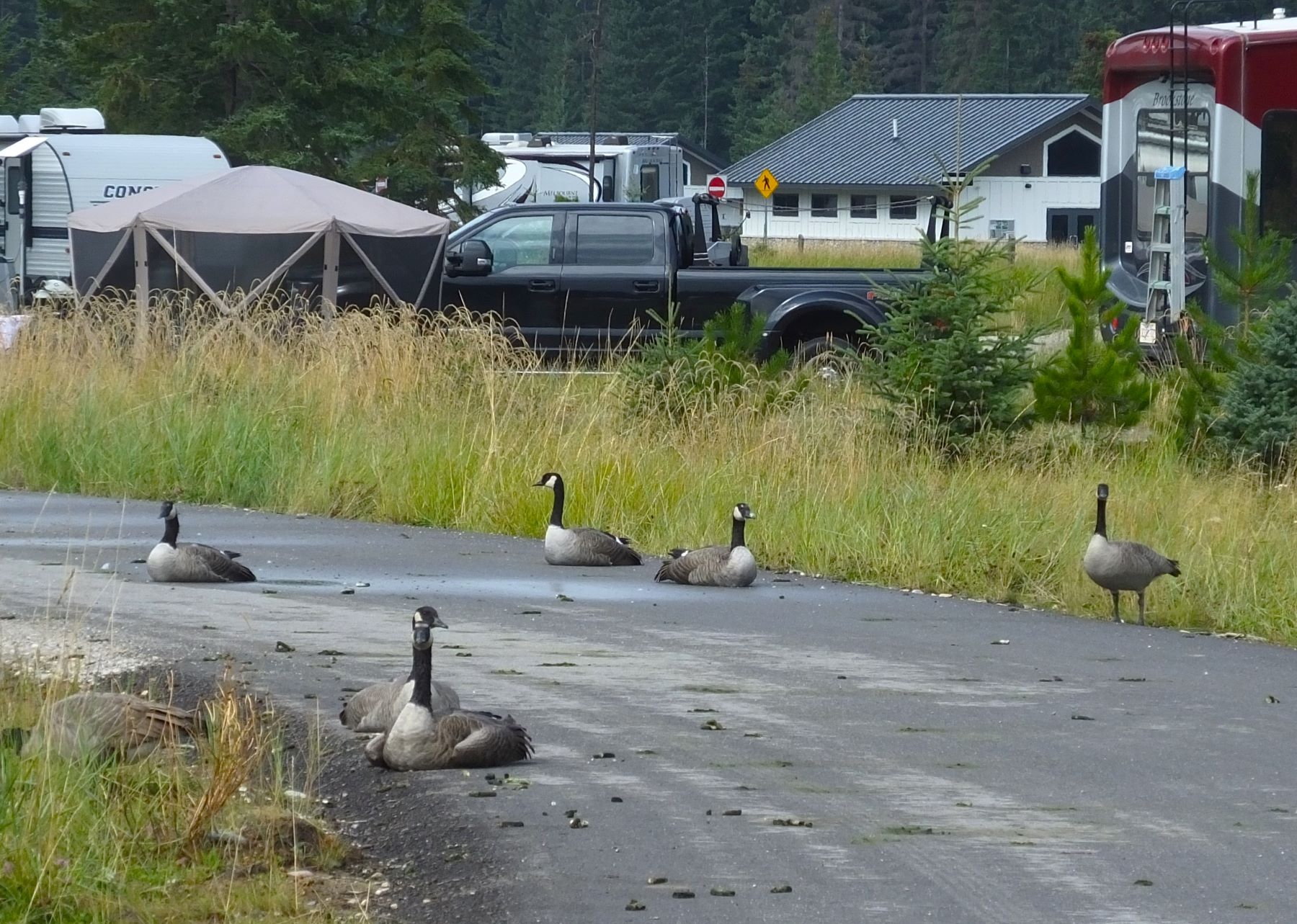
Canadian Geese – lots, especially in Jasper Campground
Grouse – 1
Bighorn Sheep – 6

Big horn sheep near entrance to Jasper NP; Canadian geese left unsavory calling cards in the campground

Bow Lake

Cinnamon Bun Review

We stopped at Bow Lake to view the towering mountains beyond the lake. Our walk took us past Hanging Glacier Cafe where a sign indicated they had fresh baked sticky buns.

We had to give one a try.

Although not technically a ‘cinnamon bun,’ the sticky bun had nice flavor with a very slight cinnamon taste. The pastry was topped with salt crystals that gave each bite a salty, sweet crunch. Outside, we shared the bun and enjoyed the magnificent view.

Sticky bun and coffee at Hanging Glacier Cafe

Bun score – 4+ out of 5

Next week:

From Banff NP, it was still nearly 2800 miles home. We came up with a plan to make the long trip a little more interesting.

Acadia NP: Coves, Carriage Roads and Cadillac

(2022 Newfoundland Ep 4)

After saying goodbye to our friend Norm, we pointed Max and Oscar northeast for our next stop at Acadia National Park on the Maine coast.

We arrived at Ellsworth, Maine that afternoon, a few miles north of the park.  We saw lots of signs for Maine lobster – lobster dinners, lobster rolls, lobster chowder, fresh and steamed lobsters from roadside stands with large steaming pots.  Despite these temptations, we decided to wait for Newfoundland lobster.

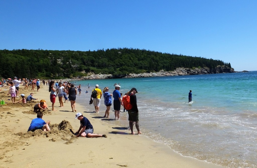
Hanging out at Sand Beach

The next morning we visited the park visitor center to get our bearings and to get our National Park book stamped.  We decided to take a free shuttle bus around the 27-mile park loop road.  The first stop was at Sand Beach, a beautiful beach where we ate a picnic lunch and watched visitors enjoying the sand, waves and summer sun.  Honestly, it was hard to get excited about the beach, considering the frigid temperature of the water and fantastic beaches we have in Florida.

Waiting for thunder…

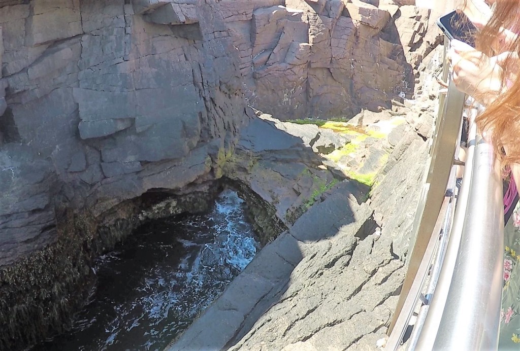
From Sand Beach we walked about a mile to Thunder Hole.  Thunder Hole is a natural formation that thunders loudly when sea water races up a narrow inlet to a small cavern.  The thunder is loudest just before high tide. We were there a little early and had to settle for fainter, distant thunder.

Lunch on the Jordan Pond House Lawn

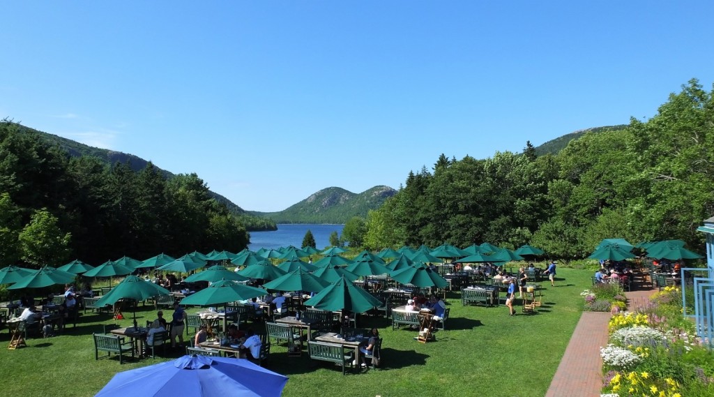
We reboarded the shuttle and rode to Jordan Pond House.  Many were enjoying dining on the lawn, an appealing grassy area dotted with chairs, tables and green umbrellas.   Having already eaten lunch, we opted for a 2-mile trail along the east side of the pond and then another trail back to the loop road and a shuttle bus stop.  Little did we know that the shuttle no longer stopped at that location.  As we considered whether to go back to Jordan Pond House or to continue along the road to the next shuttle stop, a volunteer park ranger and his wife from Tennessee kindly offered us a ride back to the visitor center.  We enjoyed visiting with them and learned we had much in common – RVing and past travels to Alaska and the US west.  

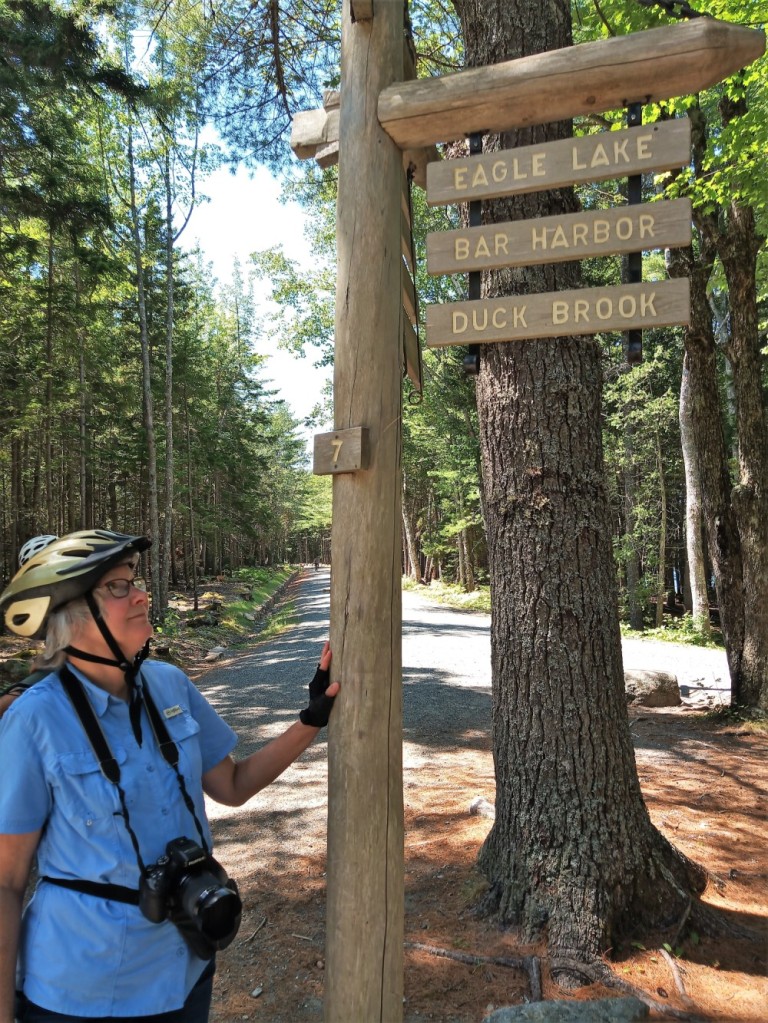
Deciding which way to go on an Acadia Carriage Road

We packed a lunch the next morning and set out to ride our bikes on Acadia’s carriage roads.  Forty-five miles of gravel lanes, gifted by philanthropist John D. Rockefeller, run throughout the park and are used by hikers, horseback and carriage riders, and cyclists.
From the visitor center we circled Eagle Lake and returned for a total of 12 miles.

Although the roads are designed so they are not too steep for horse drawn carriages, there were some rather substantial and long hills that required us to walk our bikes.  Of course, the rides back down were lots of fun!

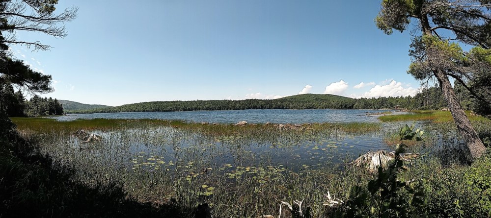
Serene Eagle Lake view

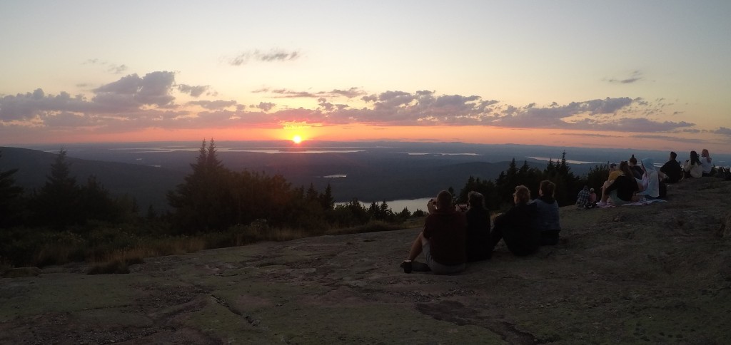
A drive to Cadillac Mountain is not to be missed when visiting Acadia.  At 1530 feet, it is the highest point in the park and offers great views of Bar Harbor town and the Maine coastline.   Many get up early to see America’s earliest sunrise from the mountain. Sunrise the next day was at 4:37 am and that would have meant we leave our campsite at 2 am.

We decided to see the sunset instead.  We brought our dinner and were rewarded with a beautiful close to the day.       

Sunset on Cadillac Mountain

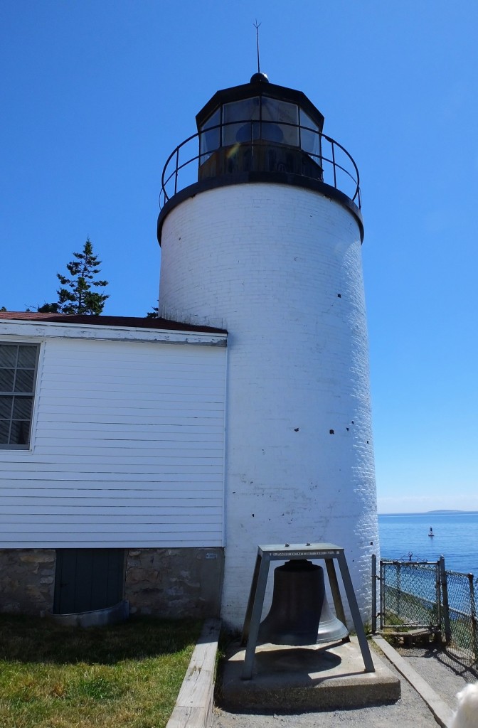
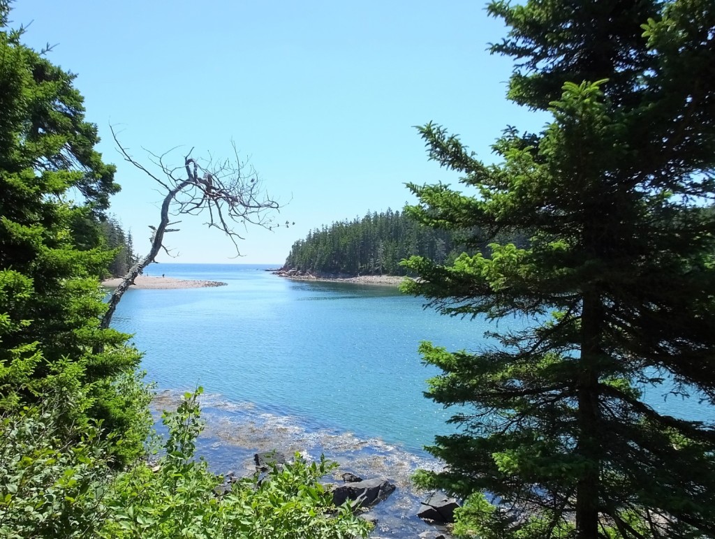
During our final day at Acadia we explored the lesser visited western side of the park.  We visited the picturesque and much photographed Bass Harbor Lighthouse and hiked to Ship Harbor, a beautiful, secluded cove. 

Next week:  we cross the border into Canada, travel through New Brunswick and Nova Scotia, and arrive in Newfoundland.

Mesa Verde NP: Where Did The Cliff Dwellers Go?

(2019 Grand Teton Ep 21)

A few miles east of the Canyonlands there are archaeological sites containing dwellings and relics of ancestral pueblo people that lived in the area until around 800 years ago.  Many of these sites are preserved at Canyons of the Ancients and Hovenweep National Monuments, Escalante Pueblo (at the Anasazi Heritage Center) and Mesa Verde National Park.

We could only spend a couple days in the area (map point 15) before continuing home, so our visits had to be short.

Escalante Pueblo and Distant Mountains
Escalante Pueblo Ruin

After seeing a hand therapist in Cortez, Colorado for my dislocated finger, we toured the Anasazi Heritage Center, a short distance from town.  The center has interactive exhibits on archaeology, local history and Native America cultures, and includes a full-scale mock-up of an Anasazi pit house from around 1000 AD.  We then walked a half mile trail up to Escalante Pueblo, a partially excavated surface ruin that has at least 20 rooms and a kiva. From the hilltop, we enjoyed views of the Delores River and McPhee Reservoir, and several distant mountain ranges.

The next morning we drove to Mesa Verde National Park about 30 minutes from Cortez.  I first visited the park with my family when I was teenager.  Pat, our children and I have visited the park a half dozen times over the years.

Although Mesa Verde is Spanish for Green Table, the park actually slopes to the south.  From the visitor center at the park entrance, added since our last visit, a steep winding road scales the face of the mesa and continues nearly 25 miles to the ruins.  The park is the largest archaeological preserve in the US, with over 5000 sites and 600 cliff dwellings.

Tickets are required for ranger-led tours of three of the most well-known and visited cliff dwellings (see below).  Unfortunately tickets were sold out the day of our visit, so we settled for two self-guided tours.

We visited Step House after hiking 3/4 mile via a steep and winding trail that descends 100 ft.  The dwelling has more than a dozen rooms and several kivas.  We enjoyed cool shadows during an otherwise warm late September afternoon.

Step House
Step House

Several miles away, Spruce Tree House has 130 rooms and 8 kivas.  It the easiest cliff dwelling to access via a 1/2 mile round trip trail that descends only 100 ft with no steps or ladders.  Unfortunately we could only view the ruin from the mesa above – the trail and cliff dwelling were closed due to rock fall from the cliff above the ruin.  The view was amazing none-the-less.

Spruce Tree House
Spruce Tree House

Here is some information about ranger-led tours – we have visited these dwellings several times previously.

Cliff Palace, the largest cliff dwelling in North America, has 150 rooms and 23 kivas, and supported around 125 people.  You must follow a steep trail with four ladders to descend to the ruin and ascend back to the parking lot.

Cliff Palace

Not far away, Balcony House has 40 rooms.  You descend a LONG (and scary!) ladder to reach the ruin, crawl through a short tunnel, and then ascend a steep cliff face back to the parking lot.  This tour was one of our favorites!

Long House is located several miles away on the Wetherill Mesa.  After hiking more than two miles to reach the ruin, you must climb two ladders and a steep staircase to the 150 room cliff dwelling.

There is much more to see at Mesa Verde, and at least two days are needed to take it all in.  The park is a fascinating place to visit.


Our homeward drive to the east continued the next day.  Near Taos, New Mexico, we encountered a different type of fascinating and rather unique dwellings.

More on our visit next week.

Canyonlands NP: Dry, Desolate and Deep!

(2019 Grand Teton Ep 20)

We left the goblins and traveled on toward Moab, Utah.

Moab is the gateway to Arches and Canyonlands national parks and is very popular for various types of outdoor adventure, including mountain biking, hiking and 4-wheel-drive driving.

We arrived in the early afternoon and learned all of the campgrounds in town were full.  With cooler fall weather, there were lots of visitors in the area.  Camping reservations are necessary during spring and fall months – something we will remember for our next time.

We continued 55 miles south to Monticello, Utah (map point 14).  In 2013, we stayed at a bed and breakfast in Monticello and know what the area has to offer.  With Monticello as a base, one can enjoy interesting day trips to the four corners area (where Arizona/New Mexico/Utah/Colorado touch), Monument Valley, Natural Bridges National Monument and the Canyonlands National Park Needles District.  Longer day trips to Moab, Arches National Park and the Canyonlands National Park Islands in the Sky District are also possible.

Canyonlands NP
Canyonlands Park Entrance

We camped in Monticello and decided to visit the Canyonlands Needles District during our one full day in the area.

The temperatures were rather warm during our late September visit so we brought plenty of water and wore hats during two hikes in the park.  We enjoyed four overlooks along the 2.4 mile Slickrock Foot Trail that had views of canyons, pinnacles and reddish peaks of the Needles area.  We were unable to see where the Colorado and Green Rivers join at the bottom of the canyon however.

Later that afternoon we hiked the nearby Cave Spring Trail, a short trail that included relics from a 19th century cowboy camp tucked under cliffs of a low mesa, interesting petroglyphs and rock art, and a couple ladders that one must climb to reach the top of the mesa.  From the top we had a panoramic view of the Needles area.

As we drove back to Monticello, we passed by Newspaper Rock, a sandstone rockface that has hundreds of petroglyphs of human, animal and material forms.  It is said to be one of the largest, best preserved and most accessible collections of petroglyphs in the Southwest.  Perhaps this was the pre-Internet Internet

We had reached the point in our journey to begin the long return to Florida.  Our next planned stop would be at Cortez, Colorado, where I would have my dislocated finger checked out and where we would visit some amazing Indian cliff dwellings.

Capitol Reef NP: Ripe Fruit Trees and Views that Please

(2019 Grand Teton Ep 18)

After visiting J.C. Penney, we continued south to Utah where we bypassed Salt Lake City and Provo, bound for Capitol Reef National Park.  In some areas autumn was evident on the distant hills, with red and yellow tinged trees.  Not the beauty of colors in the eastern U.S., but eye candy none-the-less.

We dry camped at Torrey, Utah, about seven miles from the park (map point 13).   Our campsite had a nice view of sagebrush flats leading up to clay-colored, eroded mesas.

Capitol Reef National Park extends about 60 miles north to south and is less than five miles wide at most points.  Although much of the park is remote, an eight-mile scenic drive provides amazing views.

The park is situated along a wrinkle in the earth known as the Waterman Fold.  The dramatic lifts and folds of the fold are seen all along the drive.  Two short side roads pass through narrow canyons to interesting hiking trails (time-lapse video).

Scenic Drive
Waterman Fold view along scenic drive
Canyon Drive
Driving the canyon along the Capitol Gorge spur road

We ate lunch at a picnic area in the Fruita Historic District.   The Fremont River flows through the district where Mormon pioneers built irrigation systems and planted apple, cherry, peach, pear and apricot trees.  The apples were ripe so we picked several pounds for a small fee.  Pat sliced the apples and baked them with cinnamon sugar and butter for a delicious dessert.

Freemont River
Fremont River along the Hickman Bridge Trail
Apples
Picking apples

Not far away we ventured up a 1.2 mile rocky trail to Hickman Bridge, a 130-foot natural arch near the Fremont River.  It was our first significant trail since hiking in the Tetons a week earlier where I fell and dislocated a finger.  Thankfully there were no incidents this time – only great views of the arch and adjacent canyons.

Hickman
Almost to the Hickman Bridge, a 130-foot long natural stone arch
Hickman Bridge Selfie
Hickman Bridge selfie

Tip:  We learned an important lesson while in the area.  Spring and fall months are high season – the parks are crowded and campgrounds are full.  We were told summer (hot) and winter (cold) months are less busy.  We’ll make reservations should we return one day.

Bonus Tip:  locally made fruit pies, various preserves and other items are sold in the park at the Gifford House.  The fruit pies are VERY popular – 28 dozen were sold by 2 pm on the day we visited.  All were gone when we went to the store :>(.   Stop at the store EARLY if you want to enjoy a delicious local treat!


After a couple days in the area, we headed northeast to Moab and Canyonlands/Arches National Parks.  Along the way we would have an interesting encounter with goblins.

Yellowstone NP: While in the Neighborhood…

(2019 Grand Teton Ep 15)

Yellowstone National Park is north of the Tetons.  Although we have visited Yellowstone a half dozen times in the past (including more than a week in 2018), we decided to visit again while we were in the neighborhood.

From Gros Ventre, we headed north a few miles to camp at Colter Bay (map point 10), still within Grand Teton National Park.  Colter Bay is on the eastern shore of Jackson Lake.  The Tetons rise majestically beyond the western shore of the lake.  Unfortunately the weather turned cold and rainy, and we were unable to hike or take boat tours available in the area.  Instead we did our laundry and toured the visitor center.

Colter Bay
Snow-dusted Tetons across from Colter Bay

Two mornings later, we left for Flagg Ranch (map point 11) as the weather cleared.   The tops of the mountains were dusted with fresh snow, a sign that winter was on its way.

Flagg Ranch is between Grand Teton and Yellowstone national parks, along the John D Rockefeller Jr Memorial Parkway.  We decided we would camp at the ranch for three nights and take day trips into Yellowstone.

Yellowstone National Park Map
Map of the Teton-Yellowstone area

Our Yellowstone visit bypassed most of the places we visited in 2018 – Old Faithful, Mud Volcano, several other groups of geysers and many of the viewpoints of Yellowstone Falls.   Instead we focused on areas we had not visited during recent trips or ever before.

We decided to go to Tower Fall in the northeast corner of the park.  En route we drove past Fishing Bridge, a Yellowstone River crossing just south of Yellowstone Lake.   The bridge has been rebuilt since 2018 and is now MUCH smoother.  Other road construction continues in the area and Fishing Bridge Campground will remain closed until sometime in 2021 (as an aside, Fishing Bridge is the only campground in the park with water and electric hookups).

It was strange not see herds of bison as we drove through the Hayden Valley.  They had migrated to other parks of the park.  We took a short detour along the south rim drive to see the Upper Falls on the Yellowstone River from Uncle Tom’s Trail.  The trail was closed for redevelopment during our 2018 visit.

About an hour later we arrived at Tower Fall, a 132-foot cascade along Tower Creek just before it merges with the Yellowstone River.  We viewed the falls at the start of a one-third mile trail that winds down 225 feet to the river.  At the bottom there is an interesting view of the multicolored canyon carved by the river.

As we returned to Flagg Ranch, we stopped to photograph snow-covered Mt. Washburn.  Pat and I (kind of) enjoyed a hike to the top of the mountain in September 2014 – breathless from the views and the 1400 foot climb to the peak!

Washburn Panorama
Mt Washburn Panorama 2014

The next morning we drove to the west side of Yellowstone to hike the Grand Prismatic Overlook Trail.  Parking at the trailhead was very crowded and we shared the trail with many others as we hiked one mile to the overlook.  We took our turn enjoying the view of the colorful spring.

Grand Prismatic Spring
Grand Prismatic Spring from Overlook

Later in the day we visited the Norris Geyser Basin to see Steamboat Geyser.  Steamboat is the world’s tallest currently-active geyser and has been in an active phase since March 2018, with 71 eruptions through our visit in late September.  The erupting geyser plume is more than 300 foot high and usually lasts between three and 40 minutes.

A worker at the adjacent National Park bookstore told us Steamboat eruptions were very load.  “It roars like a locomotive,”  he said.

Signs in the nearby parking lot warned vehicle paint could be damaged by fallout from the geyser.  Some area workers even had covers on their cars.

The geyser did not erupt during our visit.  We had to settle for spritzes of about 15-20 feet.  Our truck was unaffected.

Steamboat Geyser
Little action at Steamboat Geyser
Steamboat Warning
Warning: Park at your Own Risk

After more than a week in the Teton/Yellowstone area, it was time to start heading home.  We had a decision to make – head north to Montana and the Dakotas, or south to canyon country in Utah.  We’ll let you know the outcome next week.

Ansel Adams Wannabe?

(2019 Grand Teton Ep 14)

Snake River
Tetons from Snake River Overlook
Barn
T A Moulton Barn on Mormon Row

Some of the most stunning photographs of America’s national parks were taken by Ansel Adams.  His most famous and remarkable photographs were taken in black and white, and include classic images of Half Dome in Yosemite and the Tetons from the Snake River Overlook.

Adams’ story is intriguing.  He was not a successful student, suspected to be hyperactive and may have suffered from dyslexia.  Early in his life piano was his intended profession, but a love of nature and association with the Sierra Club and several noted photographers led to a lifetime as a naturalist who captured wonderful and now iconic images.

His technical mastery of such creative photography was remarkable. He would spend eighteen or more hours per day for days and months on end mastering his craft.  See Ansel Adams for more interesting details.

The beauty of the Tetons makes for excellent photographs.  In the age of digital photography, one can do a reasonable job of capturing some of the same amazing elements made famous by Adams.

Dunraven Pass
Gallatin Range from Dunraven Pass (Yellowstone NP)
Yellowstone River
Yellowstone River in Hayden Valley (Yellowstone NP)

Next week – we head north from the Tetons to visit America’s and the world’s first national park – Yellowstone.

Lessons of the Unexpected

(2019 Grand Teton Ep 13)

Despite our attempts to plan for and control everything, unexpected things happen.  Familiar surroundings, familiar repair facilities and familiar hospitals and doctors at home help us deal with most unexpected events.

But when you are thousands of miles from home and the unexpected happens, it’s a different matter entirely.


We were enjoying Grand Teton National Park after 11 days on the road.  We hiked three miles above Jenny Lake to Hidden Falls and our plans were to take a boat back to where we started.  But the last boat of the day was at 4 pm and we knew we could not make it time to catch the boat.

We viewed the falls for a few minutes and then started back up the trail, not looking forward to the 90-minute hike to the parking lot.  The trail led up a steep slope for about a half mile, followed by a long descent to the parking lot.

Then it happened.  I caught my right foot on a rock and fell.  Stumbling forward, I saw there was a drop off to the left side of the trail.  With nothing to grab onto and not wanting to fall down the side, I tumbled to the ground trying to stop myself with my hands.  My left hand jammed into a rock and my right cheek scraped along the ground.

Sprawled on the ground, I slowly tested various body parts to see if anything was hurt.  Pat helped me up and I noticed the middle finger on my left hand was bulging at a peculiar angle.  I touched my cheek and my fingers were covered with blood.

A hiker stopped and offered first aid tape to tape my throbbing fingers together.  Pat dabbed the blood from my cheek with a wet handkerchief.

As we hiked the trail to the parking lot, Pat and I discussed my injuries.  We decided I would have to visit a medical facility to have my finger and cheek looked at.

Back at our truck, we learned the clinic in the park closed at 5 pm.  So Pat began the 15 mile drive to Jackson, the nearest town.   We called our insurance provider and found out there was an urgent care facility in town, but it also closed at 5 pm.  So we headed to the emergency room at St Johns Medical Center.

We arrived a bit past 6:30 pm and anticipating high ER charges, I asked the receptionist if there were any other urgent care clinics in town.  There was one across town affiliated with the hospital, but it closed at 7 pm.

We made it to the clinic a little past 6:45 pm.  An x-ray of my finger revealed it was dislocated.  I was glad I did not need stitches for my cheek injury.

After trying twice to reset my finger, they splinted it, told me to keep it iced and made an appointment at Teton Orthopedic the next day for further treatment.

The next morning I was told the hand specialist at Teton Orthopedic had the day off.  However, when she saw the x-ray, she made a special trip to the office.  She was able to pop it in place to my immediate relief!  I was then sent to get a more permanent splint.  Shortly after noon we were finished!


Since retiring, this was our first significant unexpected medical issue.  We had several unexpected issues with our camper however during our 2018 Alaska trip – major repairs of the slide in Texas, a medicine cabinet falling off the wall along the Alaska Highway and bad wheel bearings just outside Haines, Alaska.

We realized things could have been MUCH worse in each situation – I could have been seriously injured in Grand Teton, the slide could have fallen out along the road in a remote area, or the camper could have required a long and expensive tow.

We have learned and re-learned several important lessons from the situations above:

  • We are under the watchful eye of loving God. To us, unexpected things happen.  To Him, nothing is unexpected.  Any situation can be used to glorify Him.  We don’t always know why such things happen, but we know He is in control over everything.
    (Psalm 121:8 – The Lord will watch over your coming and going both now and forevermore)
  • There are many, many people who help in unexpected situations: a man with first aid tape along a trail, a worker at an auto parts store in Haines, Alaska who gave us the name of a repairman who fixed our camper bearings at the campsite for a reasonable price, a manager at Camping World near San Antonio who gave our camper repairs high priority. The list of helpful people goes on and on.
  • Being anxious about a situation (or anticipated situation) doesn’t help. Pat and I pray, discuss. seek advice from others and then trust as God guides us.  (Philippians 4:6-7: Do not be anxious about anything, but in every situation, by prayer and petition, with thanksgiving, present your requests to God).

Unexpected things will continue to happen when we are at home and on the road.   We are called to remember and often re-learn the lessons above.   And, more often than not, we are taught new lessons as well.

Next week:  so easy, even Ansel Adams could photograph it!