2023 Alaska Revisited: Series Finale

Featured
(2023 Alaska Revisited Ep 30)

We’ve come to the end of our 2023 Alaska Revisited blog series.  It was a blessing to have you follow us for over six months and 30 episodes, and your encouraging comments were really appreciated!

This final episode provides some stats and interesting details, along with related photos. 

In addition, Pat and I answer various questions about the trip (favorite campground, best hike and so forth) – from when we left home thru Vancouver, BC, and then north thru Canada and Alaska until we returned home.   

Finally, we reveal our favorite cinnamon bun of the trip!

Route of 2023 Alaska Revisited trip

Part 1 – By The Numbers

190 days – total length of trip.  185 days were camping
137 – places we camped. The longest single stay was four days at Whitehorse, Yukon.
$21.93 – average cost per night. The most paid was $65 at Rincon Beach, California.
37 – free nights at pull offs, moochdocking, Walmart and Cracker Barrel.
$303/$413 – cost of laundry and propane.

Q&A – Home thru Vancouver – March 25 thru June 6

Rincon Beach, CA

Favorite campground

(Pat) Rincon Parkway Campground, CA – epic camping right on the Pacific.  Magnificent sunset!
(Ed) Organ Pipe Cactus NP – remote, quiet and many types of beautiful cacti

Tonto NM and desert super bloom

Favorite place visited

(P) Driving the Pacific Coast Highway:  coastline, classic bridges and elephant seals.  Enjoyed the whole thing!
(E) Tonto National Monument desert super bloom – surprise detour with steep uphill hike to cliff dwelling among yellow, gold, white and blue desert flowers

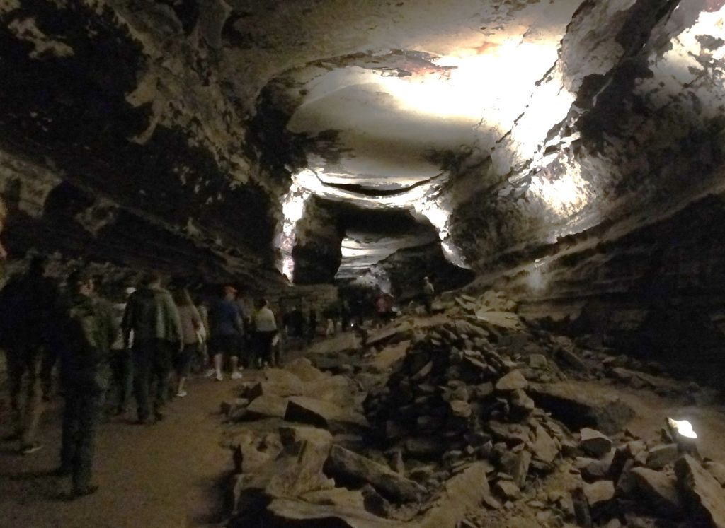
Cave hiking in Pinnacles NP

Best hike

(P) Tonto National Monument desert super bloom – see above
(E) Lower Bear Gulch Cave Trail, Pinnacles NP, CA – hike along creek in deep crevasse and up rocky stairs to a small reservoir.  We thought we saw a California condor in the nearby peaks.

Fish and chips for two in Tofino

Favorite Meal

(P) Fresh Harvest Cafe, Florence. OR – Mother’s Day breakfast, a lot of food that we really enjoyed.
(E) Big Daddy’s Fish Fry, Tofino, BC – fish and chips in a cozy little restaurant on Vancouver Island, the two-piece order was enough for us both!

The Spruce Goose spans the entire museum building

Favorite Attraction

(P) Evergreen Aviation and Space Museum, McMinnville, OR – in addition to lots of interesting planes and space displays, we got to go inside the Spruce Goose and sit in Howard Hughes’ pilot seat.
(E) Redwoods – we had a ‘wow’ reaction every time we walked among the big trees.

Sandstone waves in Valley of Fire SP

Favorite National or State/Provincial Park

(P) Humboldt Redwood State Park, CA – we camped in a Redwood grove.
(E) Valley of Fire SP near Las Vegas, NV – desert camping and hiking amid weather-etched sandstone.  We also watched big horn sheep butt horns just a few yards from our campsite.

Bixby Bridge on Pacific Coast Highway near Big Sur

Most Amazing View

(P) Super bloom of desert flowers in Arizona – beyond Tonto NM, desert blooms cast distant hills in yellow and orange.
(E) Pacific Coast Highway near Big Sur – see Pat’s favorite place visited above.

Tire swap at the Alaska border

Part 2 – By The Numbers

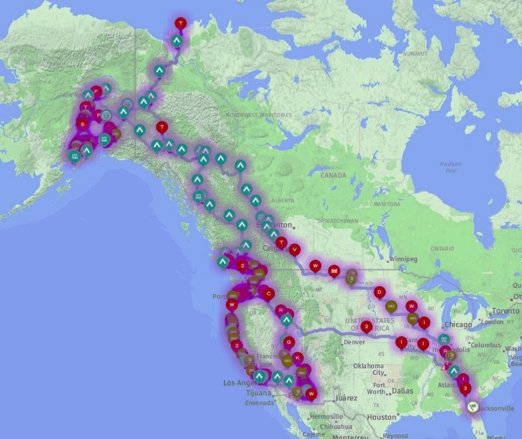
21785 – total miles driven
$8438 – total gas cost ($ 2.87/gal – lowest price at Murphy/Walmart in Warner Robins, GA, $6.31/gal – highest at Bob’s Welding, Inuvik NWT)
3 – Percy oil changes
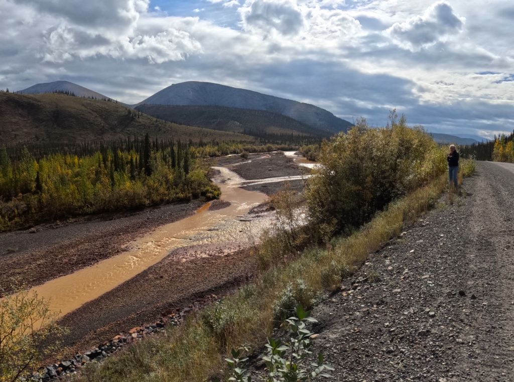
2 – flat tires – at the Alaska border and on the Dempster Highway
8 – US/Canada Border Crossings
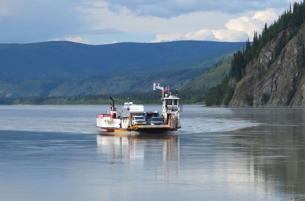
14 – ferry rides to Vancouver Island and across the Yukon, Mackenzie, and Peel Rivers, all in Canada

Q&A – North thru Canada and Alaska thru Home – June 7 thru October 1

Alaska Range view on the Denali Highway

Favorite place camped 

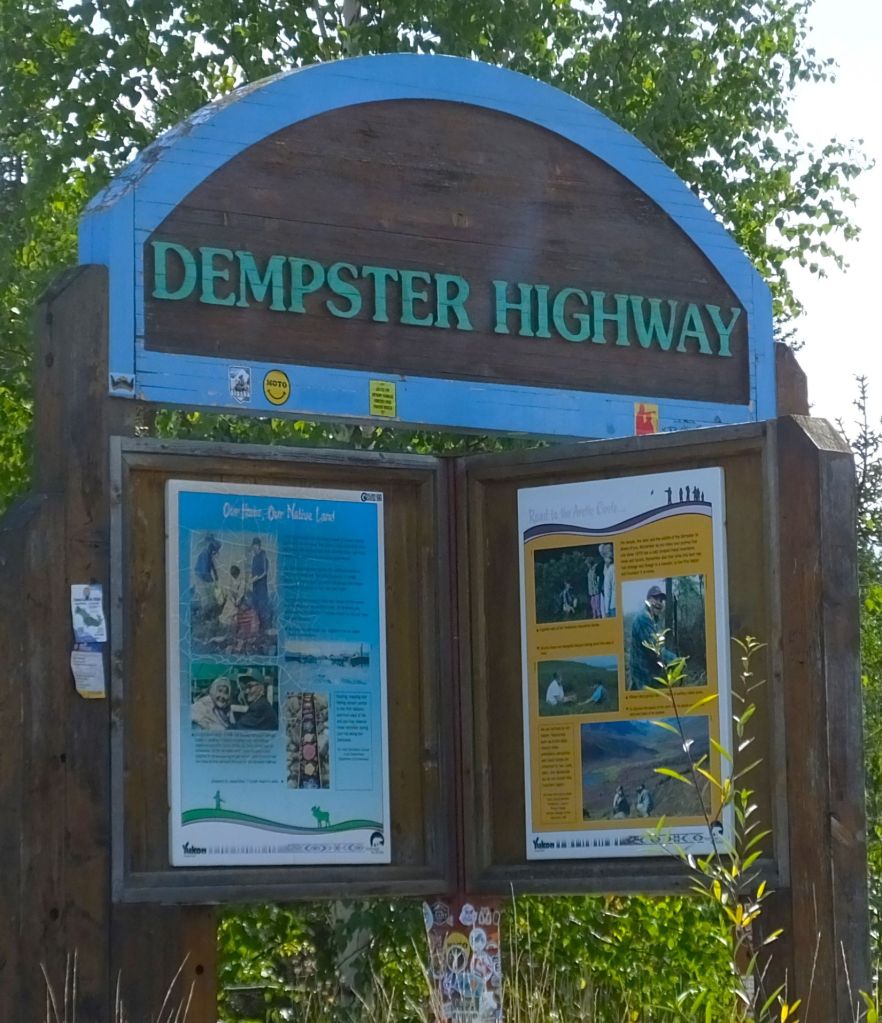
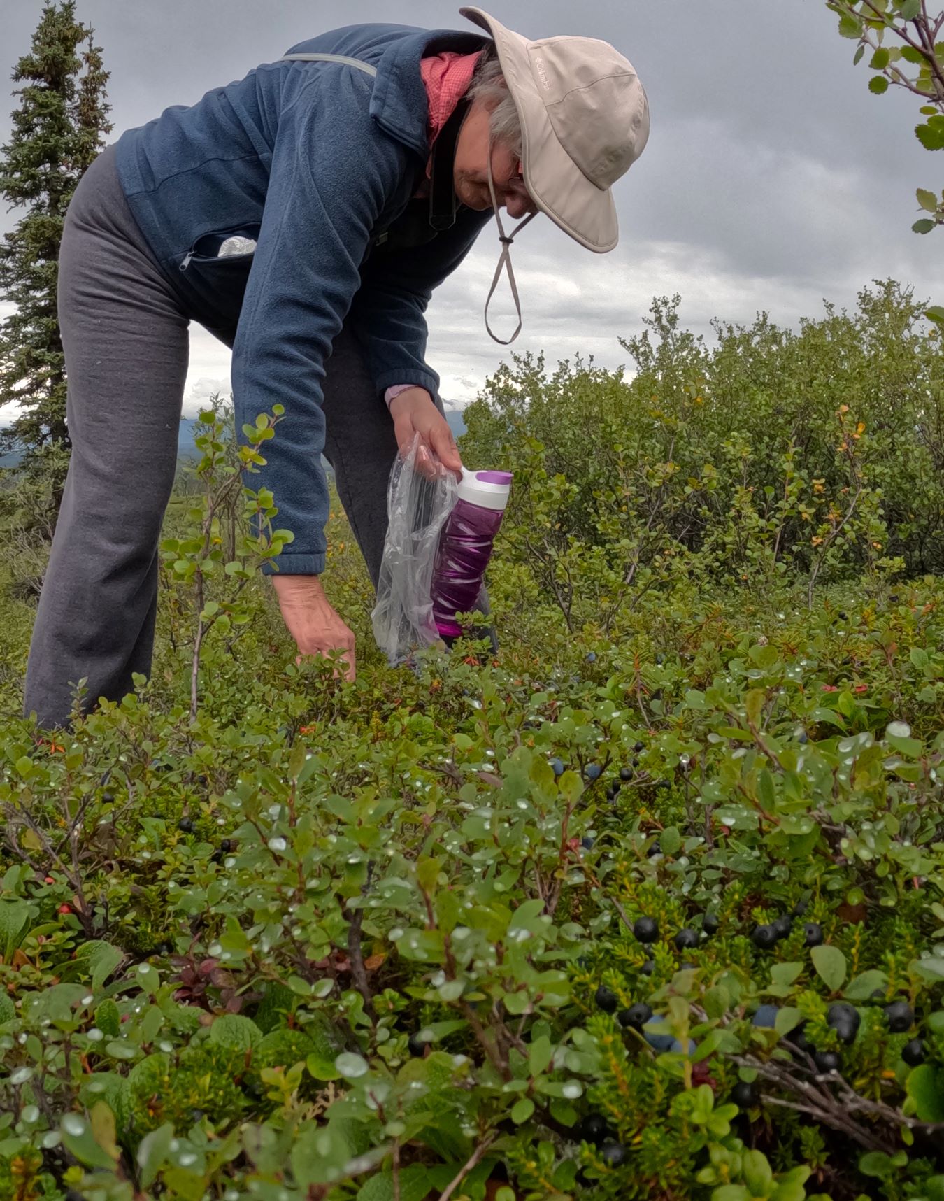
(P) Boondocking near Arctic Circle on Dempster Highway – remote pullout where we enjoyed fall colors of the tundra and picked blueberries
(E) Milepost 96 on the Denali Highway – we hiked under a rainbow with views of Alaska Range in the distance.   We were all alone!

Percy poses at the Arctic Ocean, nearly 5000 miles from home

Favorite place visited

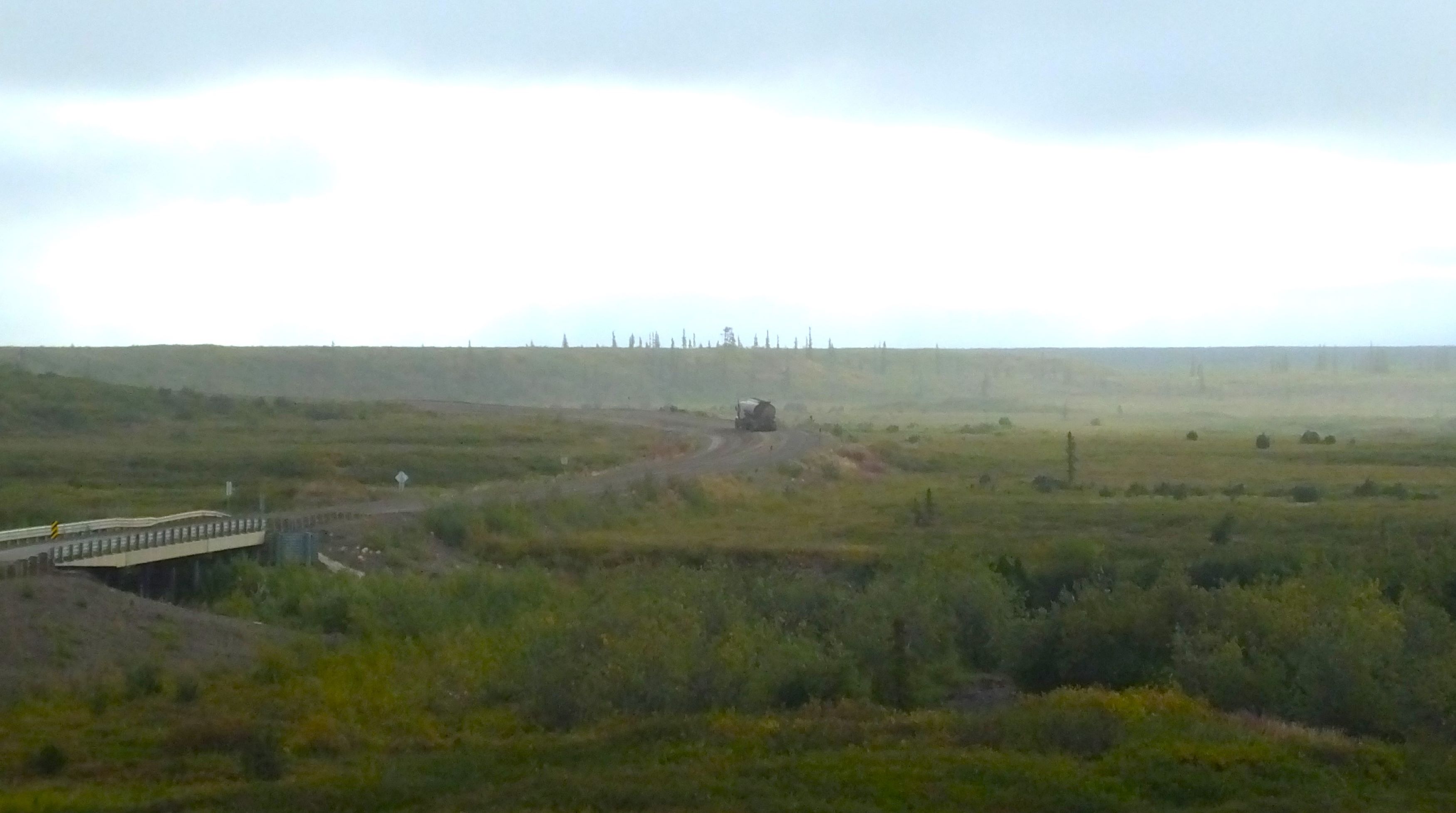
(P/E) Dempster Highway and the Arctic Ocean:  1000 miles of dirt road and a once in a lifetime experience.

Fireweed and distant mountains on the Denali Park Road

Best hike

(P/E) Denali NP near Teklanika Campground – the park bus dropped us off at Sable Ridge and we walked several miles along the road.  We enjoyed phenomenal mountain views and dodged a road-hogging caribou!

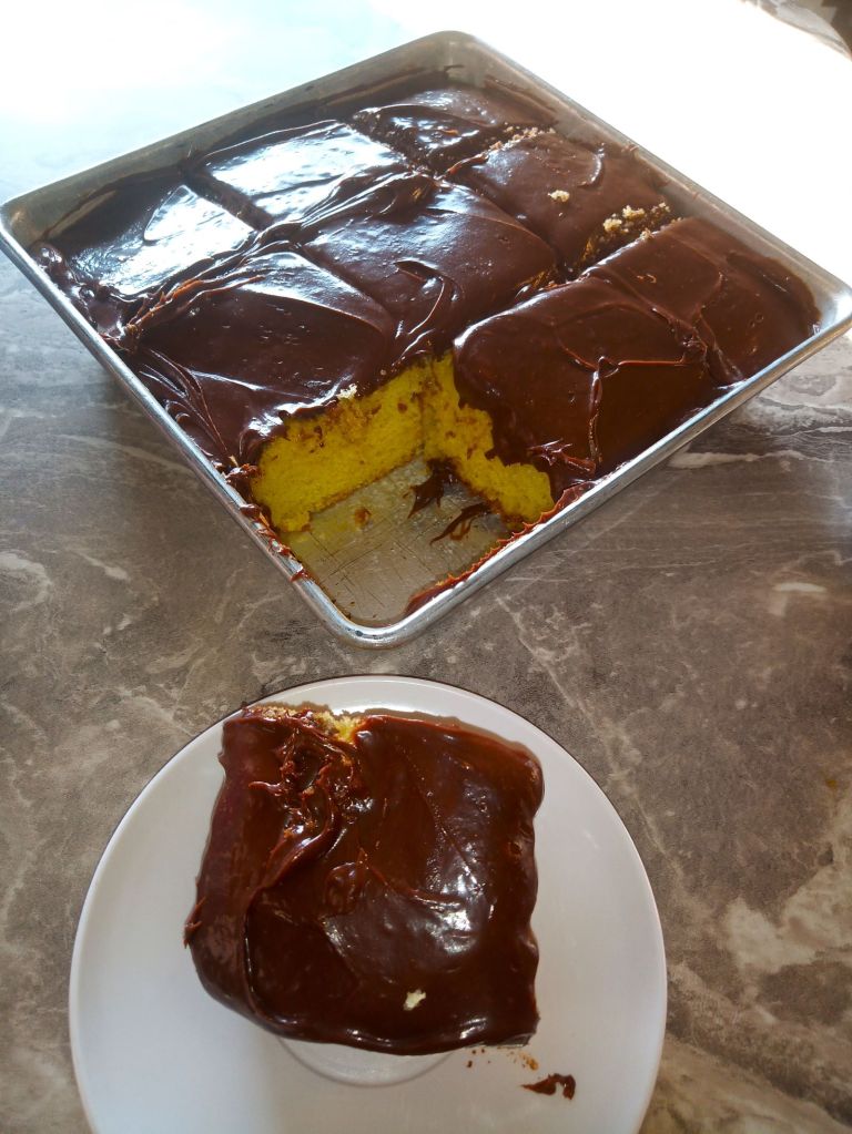
Fresh salmon and chocolate-frosted cake – a delicious way to celebrate Ed’s 66th birthday!

Favorite Meal

(P) Burger Bus in Kenai – fish/chips and a cheeseburger combo on a cold and rainy day. It brought back fond memories of Burger Bus meals on our 2018 Alaska trip.

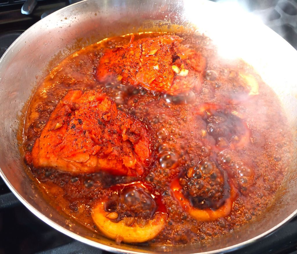
(E)  Pat’s dinner for my 66th birthday:  fresh salmon caught in an adjacent lagoon and a homemade cake.  Wow!

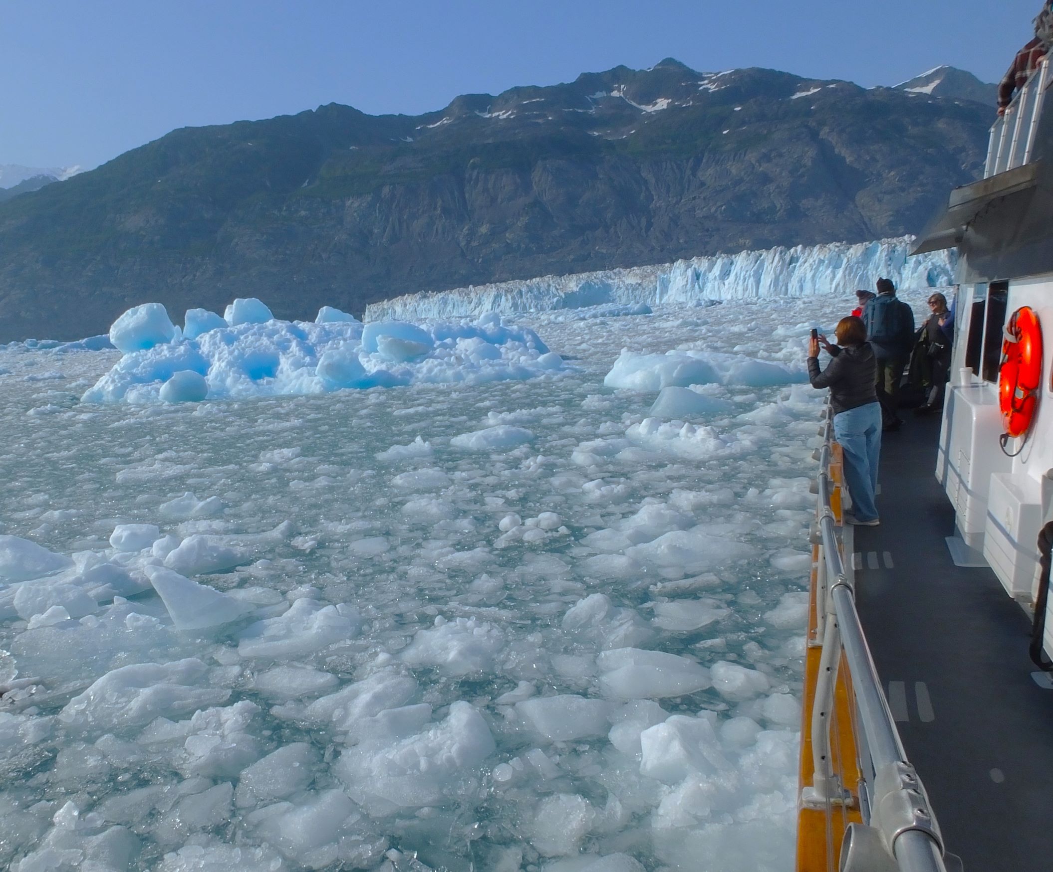
Lu-lu Belle approaching Columbia Glacier, expertly piloted by Captain Fred

Favorite Attraction

(P/E) Lu-lu Belle glaciers and wildlife cruise near Valdez – ten-hour cruise to see seals, puffins, whales, goats, and the Columbia Glacier.  It was amazing!

Bugling elk in Jasper NP

Favorite National or State/Provincial Park

(P) Denali NP – four days of great views, hikes, and camping.
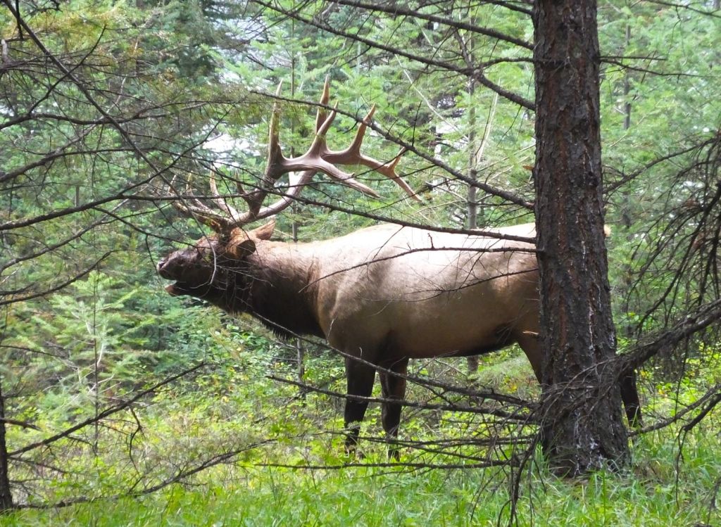
(E) Jasper/Banff NP – bugling elk and spectacular Rocky Mountain views

Peyto Lake view in Banff NP

Most Amazing View

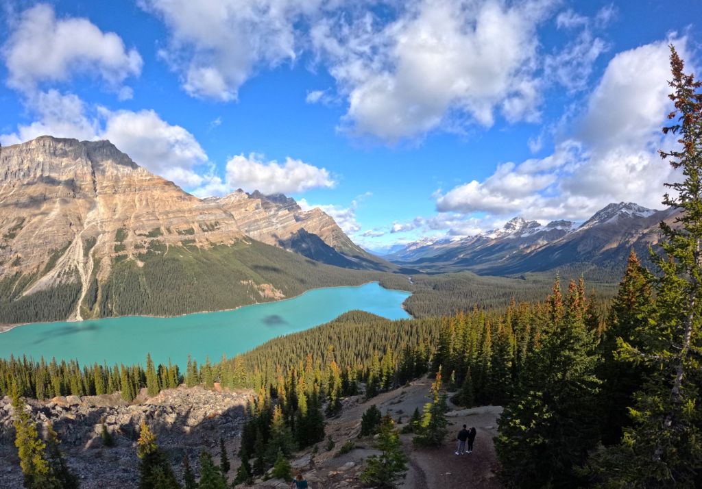
(P) Peyto Glacier and Lake Overlook, Banff NP – we were rewarded after a VERY steep hike to the overlook.  The blue color of the lake was beautiful.
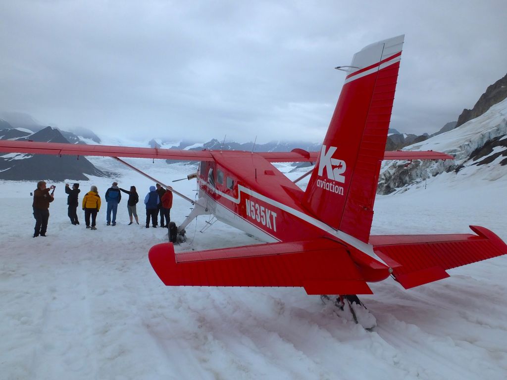
(E) Denali Airflight – we flew through rugged mountains near Denali and landed on a glacier!

Checking the daily schedule….

Part 3 – By The Numbers

18 – moose, all mamas and babies, no Bullwinkles.
30 – bears, 14 grizzly and 16 black bears.
Billions and billions – hungry mosquitoes.
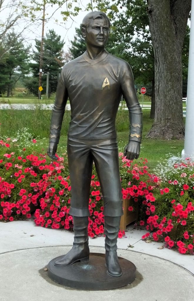
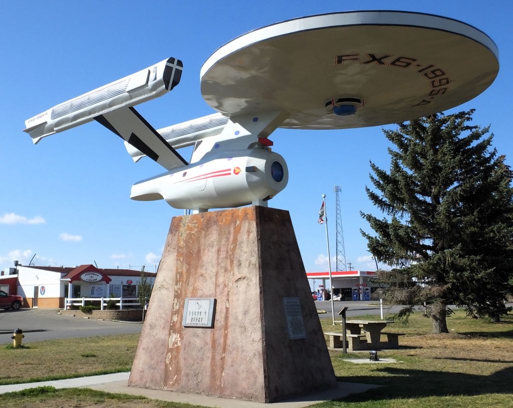
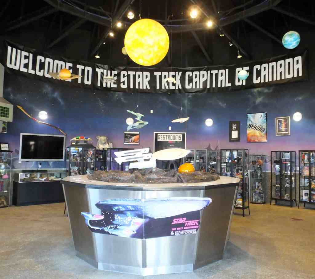
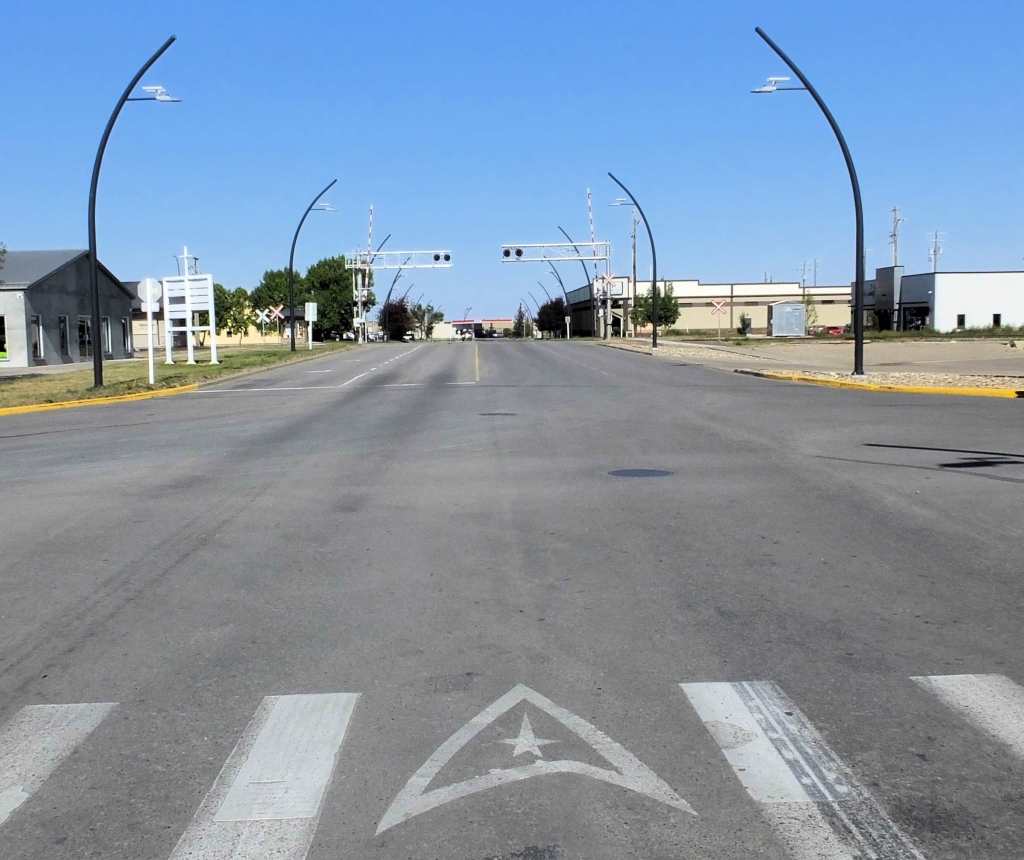
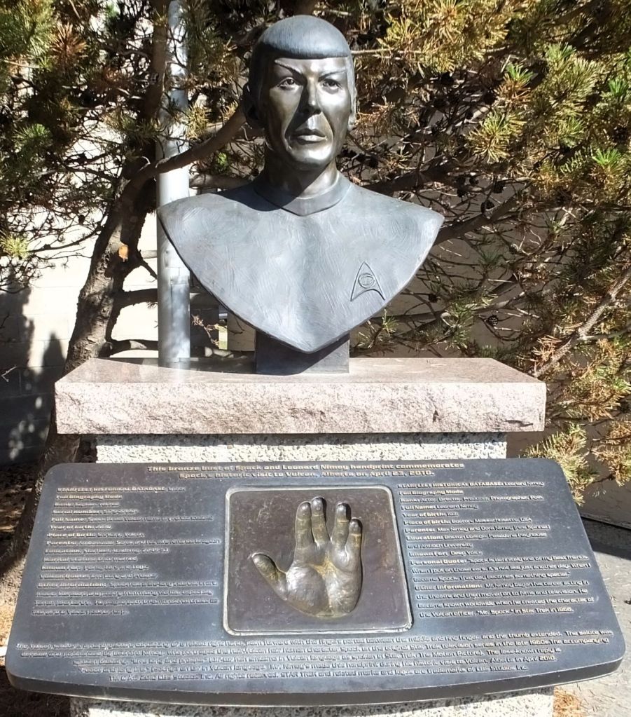
3 and 2 – Star Trek-themed attractions and Gorns.
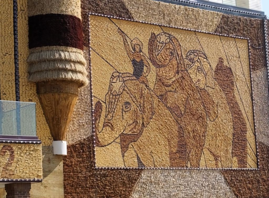
100,002+ – signs in the Watson Lake signpost forest, including two of ours.
320 feet, 11 inches – wingspan of the Spruce Goose H-4 Hercules
20310 feet – elevation of the Great One, Denali
22 hours, 6 mins – length of day on June 27 at Chena Hot Springs near Fairbanks
7/15/23 10:48 pm – 7.2 magnitude earthquake for which we received scary cell phone evacuation alerts. 
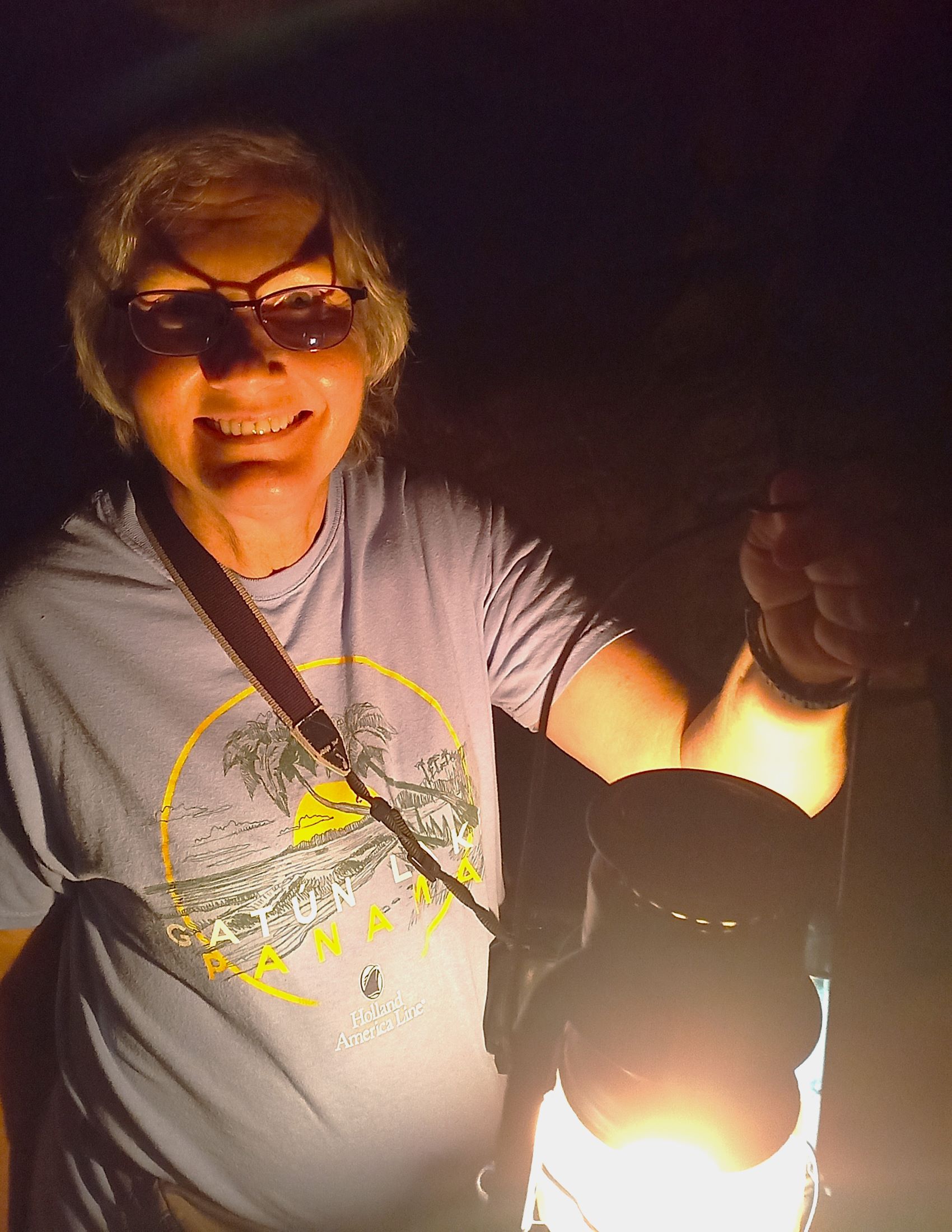
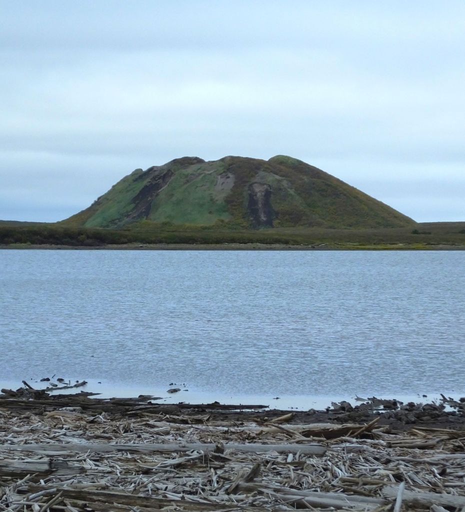
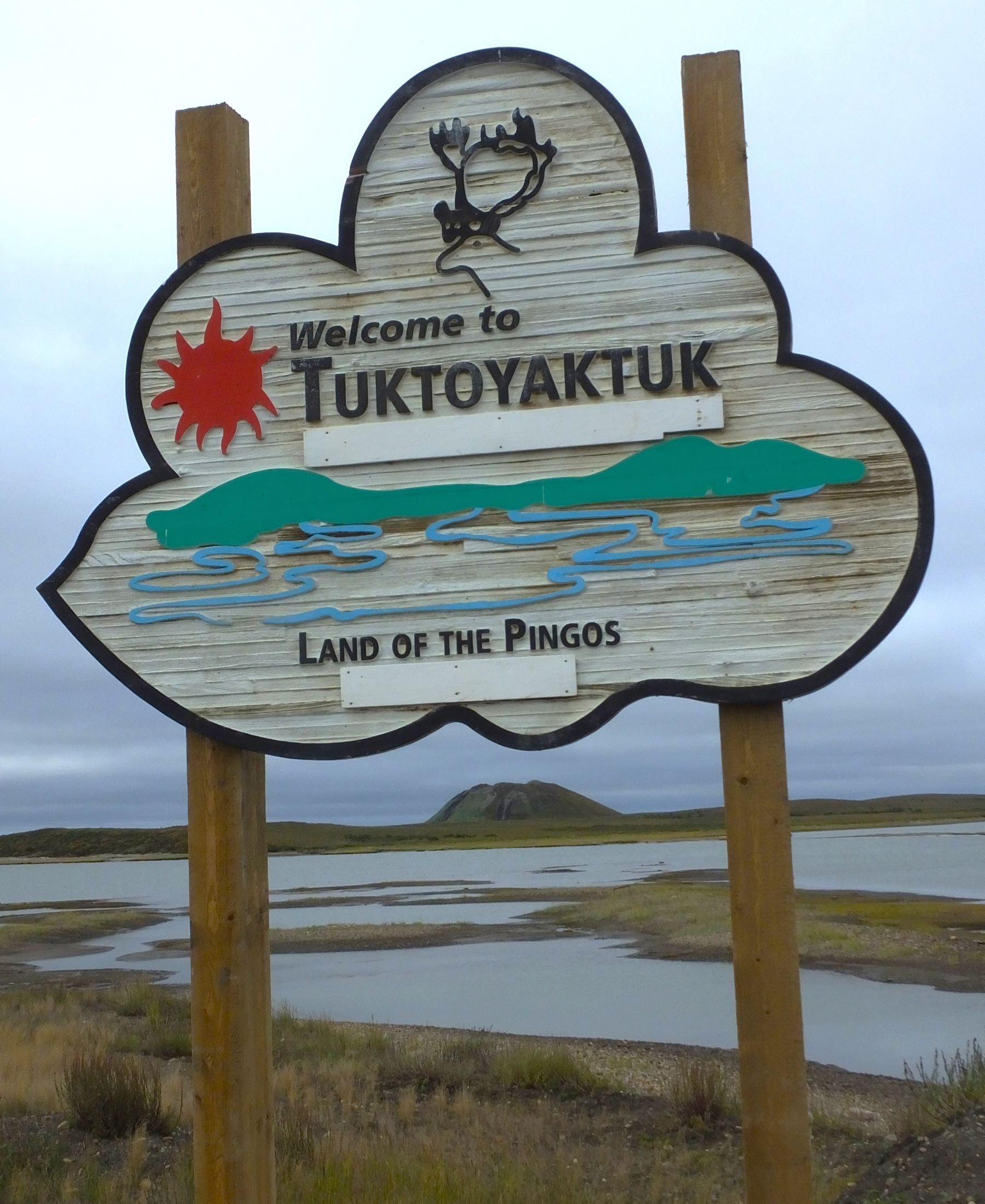
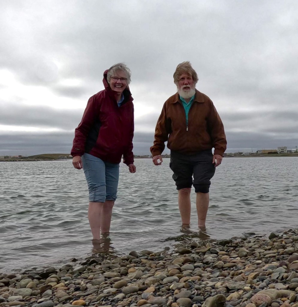
20 – frozen toes that dipped into the Arctic Ocean at Tuktoyaktuk, NWT.
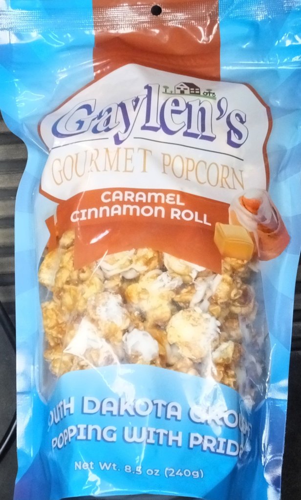
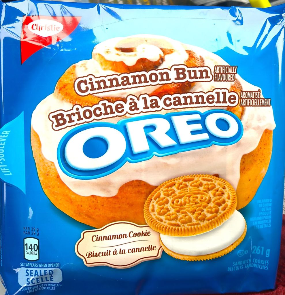
13 – Cinnamon buns eaten (countless calories) (doesn’t include cinnamon bun-flavored cookies and popcorn).
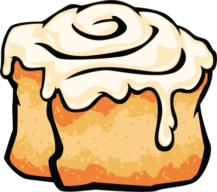
Best Cinnamon Bun

And now, the big reveal you have been waiting for. 

It wasn’t an easy choice, but we agreed our trip’s BEST cinnamon bun was at Braeburn Lodge, an unostentatious restaurant an hour north of Whitehorse, Yukon.

Best bun from Braeburn

We split a huge, pillowy, cinnamon, deliciously-iced bun – bun perfection by any measure!

Looking Ahead to 2024

In the new year we will explore new RabbiTRAILs at a couple north Florida state parks in January and then camp in the Florida Keys in February. We’ll have other travel plans to announce as the year unfolds.

See you in 2024. Have a blessed Christmas and Happy New Year!

Badland Raves and Mammoth Cave

Featured
(2023 Alaska Revisited Ep 29)

Our trip home included visits to two national parks.

Theodore Roosevelt National Park

After the death of his wife and mother on Valentine’s Day 1884, Teddy Roosevelt sought solitude and healing in the North Dakota Badlands.    The rugged landscape and strenuous life that he experienced there helped shape the conservation policy we benefit from today.

The rugged badlands at Theodore Roosevelt National Park in North Dakota

His ranch and two nearby areas are now part of Theodore Roosevelt National Park. 

The Little Missouri River winds through the park

We spent three days in the park and marveled at the weathered landscape and the Little Missouri River that winds through the park.  Two scenic drives provided plenty of viewing opportunities of deep, layered canyons that cut into the grassed prairie and a wide variety of Great Plains wildlife, including bison, pronghorn antelope, elk, bighorn sheep and wild horses. 

God owns bison on a thousand hills… (Psalm 50:10 paraphrase)
This brute eyed us from atop a drop-off. We kept our distance!

We hiked two miles along a small canyon to hard packed bottom land.  The trail passed small dirt piles with a few prairie dogs scurrying about.  We were at the prairie dog suburbs. 

Ahead, we came to many, many more dirt piles and hundreds of the yapping terrier-sized critters that announced our arrival.  Some scurried in and out of holes, and others sat or sprawled lazily, watching us closely.  This was TRNP’s prairie dog city!

Citizens of TRNP prairie dog city

Later we saw a number of unusual cannonball-shaped rocks along the base of an eroded canyon wall.  These were spherical concretions formed by mineral deposits dripping through gaps in the sediment.

Unusual cannonballs jut out of the eroded hillsides, some more than four foot in diameter

A Close Encounter of the Bison Kind

We saw telltale evidence of bison throughout the park.  Individuals and small groups wandered up and down the hills and valleys, including one group of nearly a dozen bison that walked in the middle of one of the scenic drives. Several passed within feet of our truck!

Several bison walked on the road right by our truck

Our mid-September visit to TRNP was enjoyable: the scenic drives and trails weren’t crowded, campsites were available in the park and the weather was pleasant.  If you pass through North Dakota on Interstate 94, the park is a great stop.

We visited the monument of the Lakota Indian holy man and leader Sitting Bull. It is located on a remote bluff above the Missouri River near Mobridge, South Dakota.

From TRNP, we continued south, visiting many of the roadside attractions mentioned recently in RabbiTRAILS episode 27 and episode 28.

Mammoth Cave National Park

Closer to home, we visited Mammoth Cave National Park in south-central Kentucky.  Explorers have surveyed and mapped 426 miles of the cave, making it the world’s longest known cave system.

Our last visit to the cave was in 1991, when we took several ranger-guided cave tours with Liz and Phil, our (now) adult children.  32 years later, our tours included the Extended Historic Modified Tour and Violet City Lantern Tour.

Percy and Pap would easily fit in some Mammoth Cave passages
Something to ponder: when does graffiti become a historic artifact?
Mammoth Cave’s bottomless pit is actually 105 feet deep

We hiked a steep trail down to the cave entrance where we entered the cool cave and walked nearly two underground miles on the two-hour Extended Historic Modified Tour.  The tour included many of the historic areas that originally made the cave famous – visits to huge rooms that gave Mammoth Cave its name and much tighter places deep inside the cave. We endured the narrow passage through fat man’s misery and welcomed the underground restrooms in great relief hall that followed.  The tour also included a side trip to the site of the 1840s Mammoth Cave experiment to treat consumption.

Getting ready for the big squeeze on the way to great relief hall

The next morning’s Violet City Lantern Tour was exclusively by lantern light.  For nearly three hours, we followed the dimly lit three-mile trail as it wound through huge, broad tunnels. We climbed and descended several steep hills on our way to the cave exit. The exit was several miles from the original cave entrance and a bus took us back to the visitor center

The three-hour tour was illuminated with kerosene lanterns

Mammoth Cave has few flowstone formations typically seen in caves. The formations above are at Wondering Woods Cave, a separate cave a few miles from the main cave
Pat walks the mat to save a bat. At the end of each cave tour, we walked across a bio-security mat that kills fungus spores that cause white-nose syndrome fatal to cave bats

Mammoth Cave tours are moderately strenuous. Some of the trails include series of stairs and a few steep climbs.  The rangers do a great job providing interesting historical and geologic details.  Before visiting, we recommend researching the cave tours and buying tickets in advance, as many tours sell out during the busier late-spring and summer months.

Critter Count

bison – many
pronghorn antelope – 36
wild turkey – 11
deer – 16
wild horses – 20
sandhill cranes – 2
prairie dogs – many
snakes – 3
skunk – at least 1 (by the smell)

Next week

We wrap up our 2023 Alaska Revisited trip with a by-the-numbers recap. Pat and I will compare our answers to several questions that include best trip experiences, favorite places camped and most amazing views. 

And we will reveal our pick of the best cinnamon bun of the trip!

Roadtrip Ramblings Pt 2: Mystery Meat, Matchsticks and More

Featured

(2023 Alaska Revisited Ep 28)

We hope you are enjoying our roadtrip RabbiTRAILS.  They helped make the long trip home fun and interesting.  Apart from Matchstick Marvels below, all of the places we visited were free. 

A good source of information to plan your own roadtrip to uniquely odd tourist attractions is the Roadside America website.

Matchsticks by the Millions

When I was (much) younger, I shaved the heads off matches and packed them into a copper tube with a flattened end to make a rocket engine of sorts.  After a few (very) low orbit flights of my not-quite-SpaceX booster, I was challenged with what to do with the headless matchsticks. 

We’re not sure if Iowa artist Patrick Acton got his start shaving matchsticks to fuel homemade rockets, but he definitely found a use for matchsticks.

Millions of them.

We stopped at Matchstick Marvels, a small museum in Gladbrook, Iowa.  There, we were amazed by the detailed scale models Acton has created using millions of two-inch-long matchsticks over the last 44+ years.

US Capitol model made from thousands of matchsticks
The details of the Notre Dame Cathedral model were phenomenal!

There was an amazing lighted model of the US Capitol and an intricate model of Notre Dame Cathedral.  A huge Apollo 11 complete with the Saturn V rocket engine and command module soared above us. 

A variety of models are on display in the small museum, from a Space Shuttle poised for takeoff and the USS Forrestal aircraft carrier, along with other ships, several types of planes, dinosaurs and other animals.  

A model of Hill Valley from Back to the Future even included a time traveling DeLorean

A particularly interesting creation was of Hill Valley, the fictional town from the Back to the Future trilogy. The matchstick town was complete with various buildings, courthouse, clock tower and even a DeLorean.

Acton’s creations can be seen in a number of Ripley’s Believe it or Not! Museums throughout North America, Europe and Asia.  They have been featured on numerous television programs and in various publications.

Plowing the Prairie and Feeding the World

As we drove along the gently rolling hills of Minnesota and Iowa, Pat and I were fascinated by rugged farm machinery plowing fields and harvesting crops.  Quite often the equipment was green and yellow and emblazed with the well-known John Deere logo.

John Deere Tractor and Engine Museum in Waterloo, Iowa

We visited the John Deere Tractor and Engine Museum to learn about the history and products of the John Deere company.  The museum includes dozens of restored tractors and other farm machines, various artifacts, and hands-on exhibits.

The John Deere Model D tractor was produced from 1923 to 1953, longest model run of any John Deere tractor
The John Deere 4010 tractor was the first of a new generation of tractors produced from 1960 to 1963. The John Deere 4020 model that followed is regarded as the most popular tractor ever produced by the company

Farming equipment on display ranged from plows and early tractors to an ultramodern air-conditioned tractor with a GPS guidance system.    

What an impact John Deere and other farm machinery manufacturers have had on producing food for a hungry world!

We Get Spammed

As we prepare for RabbiTRAILS journeys we often purchase a can of SPAM in case we are somewhere where groceries aren’t available. 

Pat claims SPAM is most palatable when thinly sliced and cooked until crispy. We’ve tried various flavors, including hickory smoke, maple, hot and spicy, and bacon. They pretty much taste the same. Suffice it to say SPAM is not our favorite menu choice.  

Our greeters as we entered the SPAM museum

Although we had already satisfied our ‘one can of SPAM per trip’ allotment, we stopped at Hormel’s SPAM Museum in Austin MN, to learn all about SPAM!

Bright and interactive displays in the SPAM Museum

Introduced in 1937 as an affordable source of protein during the Great Depression and way to sell pork shoulder, SPAM was named by the brother of a Hormel Foods executive, allegedly the contraction of ‘spiced ham.’  More than 150 million pounds of the pink stuff were consumed by US soldiers during World War II.  They also used SPAM grease to lubricate their guns and waterproof their boots!

Height: 21.5 SPAM cans, beard length: 1.5 SPAM cans

SPAM has been celebrated and maligned over the years as ‘specially processed American meat’, ‘spoiled ham’, ‘stuff posing as meat’, and ‘scientifically processed animal matter’.  Who can forget the Monty Python skit with Vikings chanting ‘SPAM, SPAM, SPAM… ‘, that eventually became the source of the word ‘spam’ to describe unwanted emails.

In case you were wondering, SPAM contains just six ingredients: pork shoulder, water, salt, potato starch, sugar, and sodium nitrite.
A portion of the international SPAM exhibits

Fifteen flavors of SPAM are currently sold in more than 44 countries.  There are international SPAM-related cultural displays and recipes, including exhibits from the Philippines, South Korea, Japan and Hong Kong, where the canned meat is particularly popular. 

Lovin’ It in Hawaii – SPAM, scrambled eggs and rice (from YouTube)

Overall, the US consumes the most SPAM.  Hawaiians have the highest per capita consumption in the US, averaging more than five cans a year per person.  SPAM is even available in many McDonald’s locations in the Aloha state.

205 Years from Now

Earlier in our trip we visited Vasquez Rocks Natural Area near Los Angeles (2023 Alaska Revisited Ep 7), where several episodes of Star Trek were filmed. Last week, we blogged (Ep 27) about our visit to Vulcan, Alberta, home of a Star Trek tourist center and numerous Star Trek and Spock-themed displays around the small town.

We thought it fitting to make another with Star Trek-related RabbiTRAIL stop, this time at the future birthplace of Star Trek’s James T. Kirk in Riverside, Iowa. The Enterprise captain will start his life trek on Saturday, March 22, 2228. 

Riverside, a small town in southeast Iowa near the Amana Colonies and Amish community of Kolona, has erected a monument that establishes the town as Kirk’s future birthplace.  Banners on light poles throughout the town proclaim the town is “Where the Trek Begins.”

Star Trek-themed banners seen throughout the town; we wondered if the Enterprise obeyed the posted speed limit

A Star Trek museum wouldn’t be complete without Gorn; the future Captain Kirk even has his own bronze statue

We stepped inside the Voyage Home History Center just around the corner from the plaque to peruse their Star Trek displays and memorabilia. We learned during the last weekend of June next year the town will host their 39th Trekfest, celebrating all things Star Trek with special guest speakers, costume contests, sports events, a large parade, fireworks and more.

Pat was still trying to beam herself home

One of Riverside’s taverns used to claim to be the location where Captain Kirk was conceived.  Guess we won’t know for sure for another 205 years.

This Enterprise float is part of Riverside’s Trekfest parade each June
Cinnamon Bun Review/Critter Count

None to report this week. Check back in the next RabbiTRAILS episode!

Next Week

After many miles and several mid-west roadtrip RabbiTRAILS, we visit two National Parks as we near completion of our 2023 Alaska Revisited travels.

Roadtrip Ramblings: Live Long and Prosper (and Eat Your Veggies)

Featured
(2023 Alaska Revisited Ep 27)

It’s been a while since the last RabbTRAILS update. 

Since getting home four weeks ago, we’ve been playing catchup after six months of Alaska Revisited travels:  deep cleaning Percy and Pap, maintaining our home including some minor repairs to plumbing and sprinkler heads, reconnecting with family and friends, and visiting doctors, dentists and barbers.

Over the next several weeks we will wrap up our 2023 Alaska Revisited blog.

The LONG Long Roadtrip Home

As we left the majestic mountains, roaring rivers and wonderful wildlife of Banff and Jasper NP, we faced the daunting reality that we were more than 2700 miles from home! 

To make the trip a bit more interesting, we decided to visit fun and often kitschy roadside attractions on the way home. 

We hope you enjoy our roadtrip rambles as much as we did!

Live Long and Prosper

As we headed east, the Canadian Rockies gave way to gently rolling corn and wheat fields that extended to the horizon.  Several hours later we arrived at Canada’s Start Trek capital: Vulcan, Alberta.  

Our stop in Vulcan was a follow up to an earlier visit to Vasquez Rocks near Los Angeles, where several original Star Trek episodes were filmed (see RabbiTRAILS 2023 Alaska Revisited Ep 7).

Vulcan, Alberta – Star Trek Capital of Canada

At the edge of town, we admired a large model of the Starship Enterprise and then visited the Vulcan Tourism and Trek Station, the town’s Star Trek-themed visitor center that includes an extensive, curated memorabilia collection, interactive costume displays on the holodeck and a gift shop filled with vintage Star Trek items.

Vulcan’s Trek Station, complete with restrooms!

The town has a fun and interesting Star Trek-related identity, from Enterprise models on light poles to crosswalks painted with Star Trek emblems.  On Vulcan Street, you can stay at the Vulcan Inn, buy groceries at the Vulcan Market, and even eat at the Vulcan Sushi Restaurant, before visiting a bronze bust of Spock and Leonard Nimoy handprint, and a variety of Star Trek-themed murals that adorn the town.

Vulcan’s streets are decked out in the Star Trek motif.
Spock bust and Leonard Nimoy handprint – Live Long and Prosper!

Vulcan’s interesting street murals, including doctors on various Star Trek shows and a Spock-themed ice cream shop!

Pat hoped to beam herself home…

Pat stepped into a streetside transporter, hoping to shorten the trip home.   Although it didn’t work for her, you might want to beam into town in 2024 for a weekend of Star Trek events during the town’s VULCON convention next July! 

Passing by the decked-out Corn Palace
A Palace of Corn?

Perhaps you’ve heard of Corn Palace in Mitchell, South Dakota. 

Originally built in 1892, the façade of the palace is decorated with murals made from different types of naturally colored corn, grains and native grasses.  The murals reflect a different theme chosen each year and are made by cutting ears of corn in half lengthwise and nailing them in place.  It costs $130,000 to decorate the Palace each year!

A closer view of one of the “Under the Big Top” themed murals

Inside, we were expecting an agriculture museum of some sort, with lots of information about corn and various farm implements.   

The Corn Palace is used for sports and entertainment events

Instead, the palace is a sports and entertainment facility, with bleachers, foldaway basketball nets and an open floor area for graduations, concerts and other events.  It is the home of the Dakota Wesleyan University Tiger and Mitchel High School Kernel basketball teams.

The Jolly Green Giant towers over the fields of southeast Minnesota
A Jolly Green Ho, ho, Ho

He’s the purveyor of canned cream corn and squishy little green peas. Hands are on his huge green hips, his sly grin seems to imply, “You can’t have dessert until you finish your vegetables.” 

Suppressing childhood memories of holding my nose and trying not to gag, I was favorably impressed by the tall Jolly Green Giant that stands along I-90 in Blue Earth, MN.  Built in 1978, the 55 ½ foot tall fiberglass statue is the symbol of the B&G foods and vegetable farmers in the area. 

Interesting memorabilia in the Green Giant Museum

We visited the Green Giant Welcome Center and Museum, a mere 10 giant steps across the parking lot.  The museum has an interesting collection of Green Giant memorabilia and displays about the company’s history.

About that dessert…isn’t there a place with cinnamon buns coming up?

Sprout has sprouted a beard…
They Say It’s The World’s Largest Truck Stop

If Buc-ee’s was a truck stop, The Iowa 80, World’s Largest Truck Stop is what the result would be.  The truck stop is 75 acres big, with 150 fuel pumps and parking for more than 900 semi-trucks, dozens of RVs and plenty of cars.  

After setting up at our asphalt campsite (er, parking lot) next to other RVs, we made our way to the truck stop retail building.  The building has a large area with general tourist type items (t-shirts, magnets and the like) and a separate floor with trucker gear.  There is also a food-court area with several fast food restaurants and a separate sit down restaurant. 

The truck stop has more than two acres of retail space

Need to get a haircut, take a shower or have your back adjusted?  No problem!  Those services are offered on upper floors of the truck stop.  You can also watch a movie, visit a dentist, wash your dirty laundry and more!   You won’t find those services at Buc-ee’s.

That night we were serenaded by the growls of semis coming and going from the truck stop. We missed the quiet solitude of Alaska!

Critter Count

Gorn – 1
Jolly Green Giant – 1
Sprout – 1

Gorn, Star Trek’s lizard man, on display at the Vulcan Trek museum
Cinnamon Bun Review

There were no cinnamon buns to be found after we left the Canadian Rockies. 

We were desperate. 

When we came across cinnamon roll-flavored popcorn at the Corn Palace, we HAD to give it a try.  The crunchy popcorn had the cinnamony, sweet taste of breakfast buns.  We didn’t down the exploded kernels with coffee, however!

Bun score – 1 out of 5 (great taste but nothing beats a REAL cinnamon bun!)

Next Week

We get spammed, visit another Star Trek attraction and more, as our roadtrip rambles continue.

Elk Calls and Waterfalls (and more) in the Canadian Rockies

Featured
(2023 Alaska Revisited Ep 26)

Canada’s Banff and Jasper National Parks are a common stopover for those driving to or from Alaska.  After nearly two months in Alaska and several weeks in Yukon and Northwest Territories, we decided to check out these parks as we headed home.

The parks encompass the Canadian Rockies, with Jasper NP (and the town of Jasper) to the north and Banff NP (and town of Banff) to the south.   The 143-mile Icefields Parkway, one of the world’s most scenic highways, connects the two parks.

Getting There

From Dawson Creek and the end of the Alaska Highway, we drove southeast past large wheat and hay fields at first, then across rolling hills with dense forests, and finally through low mountains.  We expected to see rugged and tall mountains along the route, but thick forest fire smoke kept them mostly hidden.

The mountains were shrouded in rain and smoke when we arrived at Jasper NP
Jasper National Park

It was drizzling when we arrived at Jasper NP and set up camp.  Near freezing nighttime temps with snow flurries were forecast, so we splurged on a campsite with electricity and water.  That night, we were thankful for the tiny electric heater that kept us warm.

We were awakened by the eerie bugle calls of nearby elk the next morning.  We couldn’t see them but knew they were there!  We opened Pap’s window shades and were elated to see sunshine and the tall mountains surrounding the campground.

A magnificent elk bugles during our trail encounter
An Elk Encounter of the Jasper Kind

After breakfast, we hiked a short trail around Annette Lake. We stopped to watch an elk rubbing its huge antlers against a small tree.  The tree shook back and forth, no match for the big animal.  The elk eyed us warily, so we made plans to take cover in a thick stand of trees nearby should the elk came toward us.  Fortunately, he walked away from us toward the lake and emitted a shrill bugle call, as if to warn us not to follow! 

Narrow Maligne Canyon with a small creek nearly 100 foot below
The Maligne Canyon widens as side creeks join the main flow

Later that day we took a longer and muddier hike along the Maligne Canyon, where a small creek flows through a deep fissure in the rocks.  We crossed several bridges as the trail followed the creek downstream. Other creeks joined the flow and we were soon following a swiftly flowing river.

We had dinner in Jasper, a town similar to Gatlinburg, TN and Estes Park, CO.  The streets and businesses weren’t busy. We were told the busy summer tourist season had ended a few days earlier.

Icefields Parkway     

The next day we started south on the Icefields Parkway.  

Turbulent Athabasca Falls

Our first stop was at Athabasca Falls, a beautiful and powerful waterfall that cascades 75 feet through narrow rock outcroppings on the Athabasca River.  The river starts at the toe of the Athabasca Glacier and eventually to the Arctic Ocean via the Mackenzie River.

Athabasca Glacier
Snow coaches and visitors on the Athabasca Glacier

A few miles south we stopped at the Columbia Icefield Discovery Centre.  To the west we could see the Athabasca Glacier extending downward from the Columbia Icefield.   The icefield is the largest in North America’s Rocky Mountains.  Big-wheeled snow coaches were taking visitors up a steep road for a short walk on the glacier (a neat experience we enjoyed in September 2014).  

Banff National Park

The next day, we continued along the parkway and stopped mid-morning to hike up a steep 1.5-mile trail to Peyto Lake Viewpoint.  At the end of the trail, we stepped onto a crowded platform for a magnificent view of turquoise Peyto Lake far below framed by the rugged mountains.

A view of Peyto Lake and the Canadian Rockies

Our drive ended in the town of Banff, where we enjoyed touring the town during our two-night stay in the area.  Parking in the area is very crowded and expensive, so we purchased day passes for public buses that go to most of the local points of interest.  It was nice not to drive for a couple of days!    

Suspended walkway in Johnston Canyon and Lower Johnston Falls

We hiked along narrow suspended walkways to Johnston Lower Falls and later visited a nice waterfall on the Bow River very close to the town of Banff.  The Bow River flows from the Columbia Icefield/Athabasca Glacier as it makes its way to the Columbia River and Pacific Ocean.

Banff is a very walkable town, with much of the downtown area closed to auto traffic

(You may find it interesting that rivers originating from the Columbia Icefield flow into the Atlantic, Pacific and Arctic oceans! Besides the two rivers mentioned above, a third, the Saskatchewan River, eventually reaches the Atlantic Ocean via Lake Winnipeg and Hudson Bay)

Banff is Canada’s first national park.  Combined with Jasper and other national parks in the Canadian Rockies, they offer amazing opportunities to see beautiful mountains and rivers, and abundant wildlife.

Like Yellowstone NP in the US, many persons visit the parks and roads/parking lots/trails/viewpoints are often crowded, even during the mid-September ‘shoulder’ season when we visited.   We recommend advance planning and making reservations for the best experience!

Our four-day visit was not sufficient to see all Banff and Jasper parks have to offer.  We hope to visit the area again in the future.

Critter Count

Deer – 5
Elk – 23
Canadian Geese – lots, especially in Jasper Campground
Grouse – 1
Bighorn Sheep – 6

Big horn sheep near entrance to Jasper NP; Canadian geese left unsavory calling cards in the campground

Bow Lake

Cinnamon Bun Review

We stopped at Bow Lake to view the towering mountains beyond the lake. Our walk took us past Hanging Glacier Cafe where a sign indicated they had fresh baked sticky buns.

We had to give one a try.

Although not technically a ‘cinnamon bun,’ the sticky bun had nice flavor with a very slight cinnamon taste. The pastry was topped with salt crystals that gave each bite a salty, sweet crunch. Outside, we shared the bun and enjoyed the magnificent view.

Sticky bun and coffee at Hanging Glacier Cafe

Bun score – 4+ out of 5

Next week:

From Banff NP, it was still nearly 2800 miles home. We came up with a plan to make the long trip a little more interesting.

A Smoky Finish to the Alaska Highway

Featured
(2023 Alaska Revisited Ep 25)

We completed the amazing and grueling 1000+-mile journey on the Dempster Highway and made our way to Whitehorse, where we caught up on more than a week’s worth of laundry and pressure washed the dirt and mud off of Percy and Pap.   

Before: Percy and Pap were covered with a thick layer of Dempster dirt and mud
After: spiffy clean and ready to continue
World’s Smallest Desert?

Catch-up chores completed, we continued south on the Alaska Highway.  We detoured a few miles to see the Carcross Desert. Said to be the world’s smallest, the desert is a series of sand dunes about a square mile in size.

Desert dunes in Canada?

Actually, the area is too humid to be a true desert.  The dunes were left behind by dried-up glacial lakes.

Smoky Roads        
Smoky conditions along the Alaska Highway

That night we camped about an hour outside Watson Lake, and arose the next morning to the smell of smoke.  The smoke was from large forest fires further south in British Columbia.  At the junction to the Cassiar Highway, the route we drove up to the Yukon in June, the road was closed due to the fires.

Pat locates our 2023 RabbiTRAILS sign

At Watson Lake, we checked on our two signs in the smoky sign post forest – we found them amidst the 100,000+ other signs on display!          

Beautiful mountains and lakes were hidden by the smoke

The next 250 miles of the Alaska Highway are perhaps the most scenic and remote of the entire route.  Unfortunately, the mountains and lakes were almost entirely obscured by the thick wildfire smoke. 

Critter Sightings

The wildlife was abundant however.

A large herd of wood bison along the Alaska Highway

One morning, we stopped to watch several large groups of wood bison grazing along the road.  There were a lot of frisky calves running about and a few adults with obvious attitudes.  We hoped they wouldn’t head butt our truck or camper.

(In case you were wondering, Canadian wood bison are larger than their US cousins. Males can reach six feet at the shoulder and weigh more than 2000 pounds)

The bison seemed unaffected by passing vehicles; this brute passed just a few feet away

We saw several black bears foraging along the road. Small groups of caribou crossed in front of us as well.

Grazing on the roadside flowers
These caribou dodged vehicles and went back and forth several times

At Liard Hot Springs, park officials have taken significant efforts to keep bears away from visitors. The campground and parking areas are surrounded with electric fencing and the entry gate looks like a secure border crossing!

It occurred to us the bears might be enjoying seeing all of the people captive within the fences!

Liard Hot Springs visitors were safe within the electric fence
Liard Hot Springs bathing area, great for a late summer swim
A Must-See Museum of Alaska Highway Artifacts

The next morning we spent a couple hours at the Ft Nelson Heritage Museum.  Marl Brown, the museum founder, collected and preserved an amazing assortment of displays and artifacts that fill more than eight museum buildings.

The museum includes a number of vintage cars and trucks, recreated trapper’s cabin, general store, post office, small church, telephone switchboard, large oil derrick, all kinds of tools and much more.  Charles Hattenstein, Pat’s dad and a collector of an assortment of interesting items, would have really enjoyed the museum. 

The museum includes dozens of vintage vehicles like these and a collection of signs and garage items

The museum is an interesting ‘must see’ for those traveling the Alaska Highway.


The final 250 miles of the Alaska Highway (going south) are generally less scenic, passing through gently rolling hills covered with dense forests and across several large rivers.  Oil and gas are produced in the region and the result is a lot of heavy equipment and pickup truck traffic.

Finishing the Alaska Highway

Beginning and end signposts on the Alaska Highway

Our 2023 trip on the Alaska Highway came to an end at Dawson Creek.   Technically, the Alaska Highway starts with milepost 0 at Dawson Creek and ends at milepost 1422 at Delta Junction in Alaska. 

Regardless of the direction traveled, the road is long and memorable.  We’ve been blessed to have driven it twice!

Critter Count

Red fox – 2
Swans – 6
Black bears – 9
Wood bison – 100+
Caribou -10
Grouse – 1
Rabbit – 1
Coyote – 1
Sassy Raven – 1 (hung out on Pat’s side mirror)

Cinnamon Bun Review

A couple hours north of Ft Nelson, we stopped at Tetsa River Lodge to try their famed cinnamon rolls.  Each bun was reasonably sized (unlike the family of four-sized buns we previously reviewed), so Pat and I each had our own bun (and coffee, of course). 

As we pulled off and ate pieces, sweet and gooey cinnamon oozed from between the coiled layers of our fresh-baked buns.  Each warm piece had a bit of icing that had melted into a perfect glaze.

Cinnamon bun perfection at Tetsa River Lodge

The buns were as good as their reputation!

Bun score – 5 out of 5

Next Week

A visit to scenic Jasper and Banff National Parks, our final RabbiTRAILS in Canada.

Dempster: RabbiTRAIL of a Lifetime

Featured
(2023 Alaska Revisited Ep 24)

Were we crazy? 

1000+ miles of dust and mud on a remote bone-jarring, tire-grinding dirt roads.  Just to dip our toes in the Arctic Ocean.

You betcha! 

This journey was a RabbiTRAIL of a lifetime.  For us, anyway.   

Drive to the Arctic?

There are two roads to the Arctic Ocean in North America. 

Alaska’s Dalton Highway – from Livengood (north of Fairbanks) to Prudhoe Bay

The Dalton Highway, constructed in the 1970s for the Alaska Oil Pipeline, runs 414 miles from Livengood (north of Fairbanks) to Prudhoe Bay.  It follows the oil pipeline as it crosses several mountain ranges and a wide expanse of the Arctic tundra. 

2018 – Our First Arctic Opportunity

In August 2018, we left Pancake in Fairbanks and followed the Dalton northward across the Yukon River, past the Arctic Circle, and camped in the back of Max at a BLM campground a few miles north of Coldfoot.   It was a cold night.  The tops of the nearby mountains were dusted with snow when we awoke the next morning.  

Camping on the Dalton Highway – our home away from home away from home…

Our overnight stop was still 230 rugged miles from Prudhoe Bay, and special arrangements were needed to visit the Arctic Ocean due to security at the oil production facilities.  So, we decided to turn back to Fairbanks. 

By the end of the trip Max was covered with thick mud from the slushy (mostly) gravel highway. We’re pretty sure several pounds of Dalton Highway mud were still imbedded in the truck when we sold it earlier this year!

2023 – A Second Chance!
Canada’s Dempster Highway – from a road junction near Dawson City to Inuvik extending on to Tuktoyaktuk

This year we had another chance to visit the Arctic Ocean – this time via Canada’s Dempster Highway

The 500+ mile dirt road starts a few miles from Dawson City as it goes north through Canada’s Yukon and Northwest Territories.  Although the Dempster officially ends at Inuvik, there is an extension to Tuktoyaktuk (Tuk), a small town on the Arctic Ocean.   

Views along the Dempster near Tombstone Territorial Park

We camped the first night at Tombstone Territorial Park (mile 46).  The gravel road wasn’t too bad, but we could see what was ahead. 

Vehicles starting the trip, like ours, were just a little dirty.  Those finishing were COVERED with dust and mud.

The Dempster can be very dusty or very muddy, depending on the weather. It was BOTH for us!

Percy and Pap were mostly clean at the start of the Dempster
Our trip continued through the mountains north of Tombstone Territorial Park
A Welcome Stop at Eagle Plains   

The next morning, we drove along a creek with unusual pumpkin orange water.  It was Engineer Creek (mile 107).

We thought it might be some sort of industrial runoff.  The water was totally natural, however, rust colored from surface iron deposits upstream.

Pat examines the rust colored water in Engineer Creek

The road continued to Eagle Plains (mile 227), first services on the highway that included gas at $6.03 a gallon, a garage, restaurant, motel and campground.   We were grateful they allowed us to connect to their wifi to check on things back home.     

Selfie at the Arctic Circle sign

A few miles north, we took a selfie at the Arctic Circle marker (mile 251).   We were surrounded by valleys and distant mountains covered with short yellow bushes. It was a sign that fall had arrived.    

Fall colors along the Dempster
The next morning we were greeted with rain and fog as we entered Northwest Territories
Foggy reminder we still had a long way to go

More views along the Dempster: wet and windy road through the mountains; we slowed often for large trucks hauling fuel and supplies to Inuvik and Tuk

The next morning we endured 40 miles of the roughest roads thus far, often driving at less than 20 mph to dodge potholes and rough washboard. 

Fortunately, when we crossed into Northwest Territory (mile 290), road conditions improved.  We were told and it was evident that NWT spends more to maintain their portion of the Dempster.

Getting ready to board the small ferry that would take us across the Peel River

At mile 337, we crossed the Peel River on a small cable-guided ferry and continued until our first major hurdle of our Dempster trip – a flat tire. 

A Roadside Tire Swap and Unexpected Connection

We hastily stopped on the side of the narrow gravel road, thankful Percy’s TPMS alerted us before the hissing tire went flat. 

We performed the previously rehearsed tire swap routine with one big change (emphasis added): raise the camper, loosen the tire lugs, jack up the truck, lower and install the spare, and CAREFULLY lower the camper ensuring the connecting wire is not underneath!

Passing drivers stopped to offer help. One driver noticed the ‘In God We Trust’ slogan on our Florida license tag.  We learned he was a Christ-follower from Edmonton working on a government fiber project along the road.  What a neat and unexpected way to connect with another believer!

Tire replaced, we continued, checking the TPMS often for additional tire leaks.   

We crossed the Mackenzie, the largest North American river that flows into the Arctic Ocean

A few miles later we crossed the broad Mackenzie River on a second ferry (mile 380) and spent the night in Inuvik (mile 456), the largest community along the Dempster.

Dempster view – Inuvik was less than 50 miles away

We discovered most businesses in Inuvik are closed on Sunday, so we had to wait until Monday to have our flat repaired.  We attended Lighthouse Community Church where we were warmly greeted by the pastor and his wife.  The service included heartfelt testimonies from several teenagers who just returned from a church camp on Vancouver Island.   We were reminded of the many fond memories we have of Camp Cedarbrook.


We wondered whether our tires could handle the rough gravel roads ahead.  This was our second flat of this trip.  New tires would be very expensive and might take a week or more to be delivered if not available in Inuvik.  We prayed for wisdom and patience. 

On Monday, the tire was repaired and we learned the flat was caused by a four-inch-long metal tube the diameter of a drinking straw.  The repairman said the tires were fine, otherwise.  Praises and thanks!

On to the Arctic

From Inuvik, it was still 90 miles to Tuk and the Arctic Ocean. We opted to leave Pap at the campground and drive the round trip to Tuk on Tuesday. 

The next morning we drove along the tundra, past dozens of lakes. Eventually we had a treeless view to the horizon. The roads were the worst of the trip and it took more than three hours to reach Tuk.  

Land of the Pingos

Nearing Tuk, we noticed a number of unusual hills in the distance. They appeared to be about 100-foot tall and several hundred yards in diameter. 

The hills were pingos, ice-cored mounds pushed up from the permafrost. 

Hills like that above are pingos – large ice mounds pushed up from the permafrost

In Tuk, we climbed to the top of a pingo for an elevated view of the small town and distant Arctic Ocean.

A viewing of Tuk and the Arctic Ocean from atop a pingo

Sitting in red Canada Parc chairs and a sign welcoming visitors to Tuk – both with a pingo in the background

We drove to the end of the road where a large blue sign informed us we had arrived at the Arctic Ocean.  The skies were overcast and the surprisingly calm ocean was gray. 

We walked along the stony shoreline, took off our shoes and socks, and carefully waded into the water.  It was windy and cold, so we didn’t linger.

Dipping our toes in the chilly Arctic Ocean
The Long Return Trip to Smoother Roads

We returned to Inuvik and began driving the 500+ mile LONG ROAD south the next morning. 

Roadside camping near the Arctic Circle with a backdrop of golden fall colors

Our return was uneventful.

We camped alongside the road near the Arctic Circle where we carefully walked through the tundra and picked more blueberries.  Near Engineer Creek, a grizzly bear was walking on the road.  We stopped and the large sandy-brown bear passed within a dozen feet of us!        

A grizzly encounter of the Dempster kind!
Dempster Reflections

Reflecting on our eight day LONG ROAD trip to the Arctic Ocean, Pat and I marvel at the remoteness and beauty of the Dempster, and give thanks for safe travels and blessings of the various amazing experiences that culminated with dipping our toes into the Arctic Ocean.  We especially appreciate the numerous kind people we met who helped make the trip interesting, positive and fun.

And finally, like others before us, our truck and camper were covered with mud and dirt, distinctions of the long and interesting Dempster RabbiTRAIL!

Desperate for a C-A-R-W-A-S-H!
Critter Count

Grizzly bears – 1
Coyote – 1
Porcupine – 1
Canada geese – many
Grouse – 26+
Eagles, Owls – 1 each
Grouse – 26+
Swans – 45+
Sandhill canes – 15+
Open range horses – many

Cinnamon Bun Review

Cinnamon buns weren’t to be found along the Dempster.   

So we tried thinking outside the bun. We tried some cinnamon bun-flavored Oreos from a small store in Inuvik.  Each crunchy cookie had a sweet cinnamon-flavored center. 

Bun score – 0 out of 5.  Oreo score – 5 out of 5!

Fortunately, we didn’t abandon our bun quest.

After completing the Dempster, we continued south to Whitehorse (on paved roads, yeah!).  A few miles from our destination, we stopped at Braeburn Lodge to try one of their famous cinnamon buns. 

The Braeburn bun is not a snack – it’s an experience! 

The owner brought a fresh-baked bun from the kitchen where the magic happens and placed it in front of Pat.  We were awestruck by the the paper-plate-sized bun. Its pillowy soft coils were layered with gooey cinnamon and raisins, and drizzled with a generous amount of white icing. Oh my!

My hun holds a bun!

We struggled to finish the four-person bun (someone had to do it!), washing down the delicious bites with fresh coffee. 

Cinnamon buns don’t get better than this!

Bun score: 5+ out of 5  

Next week:

Bears and bison on the Alaska highway

Dawson City: Gold Flows and Sourtoes

Featured
(2023 Alaska Revisited Ep 23)

A visit to the Yukon wouldn’t be complete without a visit to Dawson City, location of the historic Klondike Gold Rush.  Before leaving Alaska, we stopped at quirky Chicken, and then continued to Dawson City via the Top of the World Highway.

Chicken, Alaska
Downtown Chicken

Chicken is a surviving Alaska gold rush town with a year-round population of 17.  There’s a historic gold dredge, gas station, campground, a couple gift shops, café and saloon, and, of course, a large chicken statue. 

In 1902, town founders planned to name the community Ptarmigan. However, due to disagreement on the spelling, they named it Chicken instead.

Visitors are greeted by a big metal chicken!

After walking around the town and checking out the gift shops (which didn’t take long), we stopped in the café for, you guessed it, a cinnamon bun and coffee.  See our cinnamon bun review below to find out the results.

Crossing into Canada at the Top of the World
Pat surveys the top of the world view; smoke from several small forest fires can be seen

We continued on the Top of the World Highway, a 106-mile winding, gravel road between Chicken and Dawson City.   Trees became more and more scarce as the road climbed to over 4500 feet, and by the time we crossed the border into Canada at mile 40, there were amazing treeless views in all directions.  We were reminded of similar views along the Blue Ridge Parkway in North Carolina.

Crossing the Yukon River on the small George Black Ferry
Dawson City

We camped along the Yukon River across from Dawson City.   A 10-minute ferry ride brought us across the swift flowing river into the town.  Most of the town consists of gold-rush era buildings and aside from the paved main street, all other streets are dusty/muddy dirt with wooden sidewalks throughout.

Downtown Dawson City

After looking through several shops and eating lunch at Sourdough Joe’s, we visited the small Jack London Heritage Museum. 

Several of London’s best known short stories (To Know Fire) and novels (Call of the Wild, White Fang) are based on his experiences during the Klondike gold rush in 1897, when he spent a year in the Yukon.  The museum includes a replica of a cabin he lived in while in the Yukon, built with half of the logs from his original cabin.  The other half are in a museum in Oakland, CA, London’s hometown.      

Recreated Jack London cabin

Can-cans and sourtoes:  not our thing!

We decided to pass on a couple of well known Dawson City attractions:  Diamond Tooth Gertie’s Gambling Hall, a small casino with bawdy can-can shows each evening, and the sourtoe cocktail at the Downtown Hotel.  The toe-tally bizarre cocktail features a shot of Yukon Jack whiskey garnished with a dehydrated human toe.   Yuck!

Klondike Gold Fever       

Outside and inside views of Gold Dredge #4

Later that day we drove several miles out of town through an active gold mining area to Historic Gold Dredge #4, a Canada National Parks National Historic Site.   The dredge and others like it scooped up and filtered tons of dirt and rocks to extract millions of dollars of gold.  An unfortunate result of such mining are the rocky tailing mounds throughout the area.

Gold dredge tailings seen from Midnight Dome

There’s a public-accessible gold mining claim not far from the dredge where Pat and I panned for gold, seeking our fortunes or at least enough to pay for our next cinnamon bun.  Using pans borrowed from the Dawson City visitor center, we crouched by an icy creek where we added water to a small scoop of dirt in each of our pans.  We pulled out larger rocks and swirled away sand and finer grit, hoping to find yellow flakes glistening at the bottom of our pans.  The result?  A few specs of something, perhaps gold or (more likely) pyrite, otherwise known as fool’s gold.

Klondike Ed pans for gold (yellow cat litter bucket added for effect)
Midnight Dome
View of the Yukon River and Dawson City from the Midnight Dome

The next day we visited Midnight Dome, a lookout atop a 2911-foot mountain above the town.  People gather on the dome on the summer solstice (June 21) to watch the sun drop below the horizon and rise a few minutes later.   The sun didn’t set during our daytime visit, but we did see the town far below, as well as where the winding Klondike River flows into the Yukon.  The Ogilvie Mountains, where we drove the Top of the World Highway several days before, was visible in the distance.

Paddlewheel Graveyard

Riverboat relics in the Paddlewheel Graveyard

On our final evening we walked a half-mile along the banks of the Yukon River to explore the paddlewheel graveyard.  There we saw the collapsed and decaying hulls and paddlewheels of several boats, once the primary method of transportation on the Yukon and other rivers in the area.  As air transport became more common and the road connecting Dawson City to Whitehorse was completed in 1953, the need for such boats diminished and several were drydocked along the river.                    

Critter Count

One severed toe (which we didn’t actually see and will spare you a picture of)
All of the other critters were hiding this week

Cinnamon Bun Review

Who would think a tiny café in a remote Alaska town would have amazing cinnamon buns! 

We stepped into the small Chicken Creek Café and there they were, cinnamon buns fresh from the oven and lined up on the counter, ready for us to consume and review!

Fresh baked cinnamon buns (and more) in the Chicken Creek Cafe

Each pillowy bun was the size of two fists, golden brown, and covered with a thick layer of icing.  We cut our bun into smaller pieces, and washed down the cinnamony, sweet morsels with fresh brewed coffee.  The cream cheese icing was unusually good.   

Our tummies were bloated when we finished. It was the best bun thus far in our trip. 

Bun score – 5 out of 5  

Next Week:

1000 miles of dirt road and the Arctic Ocean.  

Alaska Wild – Three Denali Experiences

Featured
(2023 Alaska Revisited Ep 22)

Experiencing Denali, or the Great One, is high on the bucket list of many Alaska visitors.  It was high on ours as well, so we experienced Denali in three ways.

Experience 1: Camping in Denali National Park

After touring Alaska for more than six weeks we arrived at Denali NP, anticipating camping four days in the park.  Our first night was at Riley Campground, at the park entrance, where we caught up on laundry, filled Pap’s fresh water tank and dumped our gray and black tanks.  We were ready for a three-day stay at Teklanika (Tek) Campground.

Denali area map

Before continuing, here’s some information about Denali NP.    The park was established as Mt McKinley NP in 1917 to protect a dwindling dal sheep population.  It wasn’t until 1980 that the park was enlarged to include Denali, the mountain, and renamed to Denali NP.

Much of the park is remote and rarely visited.  From the entrance, there is a 92-mile road (see map above) that extends east-west into the park to Kantishna, a historical gold mining area.  After a major landslide in 2021, the road is now open only to mile 43. 

The first 15 miles of the road are paved and can be driven by visitors.  After mile 15, the road is dirt and visitors must take a bus to get to the temporary end at mile 43.  Those camping at Tek can drive to mile 29. They must stay a minimum of three days and cannot drive further into the park or back to the park entrance until they leave.  That’s three days with no electricity, limited fresh water, no way to dump tanks and no cell service.

The remoteness and wild beauty are what attracted us to Tek. 

Teklanika River, near our campground

From our campsite we walked along the ribboned channels of the Teklanika River, surrounded by beautiful mountains. 

The next day we hopped a park bus for a ride to mile 43. 

Denali park bus pauses for several willow ptarmigan

The bus groaned as it climbed the narrow, winding road up and down several mountains.   The driver shared interesting facts about the park until someone shouted ‘caribou at 2 o’clock.’  The bus stopped and everyone crowded to the right side to see a large caribou walking on the tundra about 50 yards away.  After a few minutes we continued until the next animal was spotted.

Sections of the Denali park road are closed each hour to allow dal sheep to cross the road. As Ed checks his watch, we wondered how the sheep know what time it is

We saw a number of caribou, some with antlers more than three foot long, mama grizzly bears and their cubs, a gangly moose cow, dozens of willow ptarmigan, arctic squirrels and even a couple dal sheep.  Some were on distant hillsides and others were just off the side of the road.

There were plenty of animals along the Denali park road

Fireweed and distant mountains along the Denali park road

Later, we asked to be dropped off to walk several miles along the road.  We carried water and snacks, a couple ponchos and bear spray just in case.  We took our time to enjoy views of the mountains and deep valleys. 

A Caribou Encounter of the Denali Kind
A caribou struts down the center of the park road

We stopped to pick blueberries and noticed a large animal about 100 yards away, walking toward us along the road.  It was a caribou.   On one side of the road there was a steep upward slope and on the other a substantial drop off.  We stood close to the drop off, waved our arms and made loud noises.  Did the animal get the hint and turn aside?  Nope.  He strutted down the middle of the road and didn’t miss a step as he passed less than 15 feet from us!

A taste of Denali – we picked enough blueberries to make wild blueberry pancakes!

A hike along the untamed Savage River near the Teklanika Campground

Our Tek camping experience was one of the highlights of our trip!

Experience 2: Denali By Air

We left the park and drove a couple hours south to Talkeetna for a two-hour flight to see Denali, the mountain, up close.  We flew above immense glaciers and hung on as the pilot made a bumpy landing on Ruth Glacier.  Snow covered mountains towered all around us. After a white-knuckled take off, the pilot flew through several mountain passes and near incredible cliff faces thousands of feet tall.  We saw the base and mid-elevations of Denali, but the peak was hidden by rain clouds and fog.

Cockpit view during Denali flight takeoff
Circling the mountains and glaciers near Denali
Another view of glaciers near Denali
Landed on Ruth Glacier
A chilly pose on Ruth Glacier
Experience 3: The Denali Highway
Our speed was closer to 30 mph as we drove the rugged dirt portion of the Denali Highway

Since 1971, most people visit Denali NP via the Parks Highway between Anchorage and Fairbanks (route 3 on above map). Before then, the park could only be reached via the Denali Highway, a remote 135-mile road that goes east-west along the Alaska Mountain Range (route 8 above).

Nearly 100 miles of highway is pot-holed and muddy/dusty, depending on the weather.  We drove slowly and carefully, and after 40 miles, we camped at a pull off with a view of the mountains to the north.  We picked more blueberries, stepping carefully to avoid ankle-deep wet areas in the boggy tundra, and we later hiked up a nearby hill to enjoy a rainbow produced by a passing rain shower. 

It was a nice end to our Denali experience.

Under a rainbow on the Denali Highway
Cinnamon Bun Review

Our Denali experiences were nearly cinnamon bun-less.  Stopping for groceries at Three Bears Alaska in Tok, we decided to try a couple of their grocery store cinnamon buns. 

The buns were covered with an enticing thick layer of icing.  The icing was yummy, but the bun was dry with little flavor.

Bun score – 2 out of 5

Lesson learned?   Put enough icing on just about anything (even liver) and it would earn a score of 2!   

Three Bears – Alaska’s version of Buc-ees with groceries, hardware and more; a nicely iced cinnamon bun

Critter Count

Moose – 6
Willow Ptarmigan – 60+
Dal sheep – 2
Vole – 1
Swans – 6
Beavers – 4
Porcupine – 1
Caribou – 18
Grizzlies – 9 (including a mama griz and her three cubs)
Ground squirrels, jays, magpies, seagulls  – lots

Next week: 

Our Alaska journey comes to a close and we continue on to Canada, looking forward to new RabbiTRAILS ahead! 

Alaska Wild – Kennecott Copper Mines

Featured
(2023 Alaska Revisited Ep 21)

As our time in Alaska came to a close, several RabbiTRAILS gave us a sense of how wild and remote the 49th state can be. This week we visit the Kennecott Copper Mines nestled on the western side of the Wrangell Mountains in southeast Alaska. Next week our RabbiTRAILS take us to remote campsites in Denali National Park and along the Denali Highway, where we see amazing sights and wildlife.

The efforts that humans use to obtain valued resources are amazing.  At the turn of the 20th century, thousands of fortune-seeking prospectors came to Alaska in search of gold.  In the 1970s, an 800-mile oil pipeline was built from Prudhoe Bay to Valdez to help satisfy America’s need for black gold and energy independence. 

Today’s RabbiTRAIL is about another quest for resources: copper and the Kennecott Mines in a remote area several hours north of Valdez. 

Leaving Valdez

We traveled north from Valdez on the Richardson Highway through scenic mountains and along wide rivers, and turned east on the highway that would take us 92 miles east to McCarthy and the Kennecott Mines.

We were surprised to see a herd of yaks as we drove toward Kennecott. They are being raised at the Circle F Ranch

To the northeast were ghostly silhouettes of the Wrangell Mountains, hard to see due to smoke from fires in central Canada.  Several of the mountains are nearly as tall as Denali, and on a clear day we were told the view is spectacular.

Smoke-shrouded Wrangell Mountains

The Wrangell and St Elias mountains are part of America’s largest national park.   During our drive to Alaska in June we visited Canada’s Kluane National Park on the other (eastern) side of these mountains.  Together they make up the largest international protected area in the world. 

The Kennecott Mines are a special historic district within the Wrangell-St Elias NP.

Alaska natives use fish wheels to harvest salmon on the Copper River. The fishwheels resemble a porch swing, says Pat
Kennecott Bound

We dry camped at a state park on the banks of the Copper River, about a third of the way to the Kennecott Mines.   Copper River salmon are prized for their distinctive taste.

The highway is not paved past the Copper River Bridge and quite rough and dusty as it follows an old railroad bed.   We were warned that railroad spikes occasionally surface, and not wanting to risk a flat tire, we decided to take a shuttle to the Kennecott instead.

A lone cyclist braves the bumps and dust along the road to Kennecott
A portion of the road to Kennecott follows the CR&NW railroad bed, including the 525-foot Kuskulana Bridge built in 1910. It is 238 feet above the river and cost more than a million dollars in 1910
You must cross a footbridge to get to McCarthy and Kennecott; the turbulent grey river outflows from the Kennicott Glacier

After nearly three hours, we arrived at the Kennicott River where we walked across a narrow footbridge that spans the river.   The Kennecott Mines were still five miles away, so we rode a second shuttle past McCarthy on our way to the mines.

Kennecott Mining District, with gravel-covered ice mounds of the Kennicott Glacier and Wrangell Mountains beyond

As we neared the mines, we could see the Root Glacier extending from the distant mountains and a  broad area of gravel mounds adjacent to the mining area. Although the gravel piles might appear to be tailings from the mine, they are actually on top of a thick layer of ice, part of the Kennicott Glacier.

14-story Kennecott Concentration Mill

The Kennecott Mining District has informative displays that explain the history of the area along with more than two dozen restored and well-preserved buildings, including the prominent concentration mill, machine shops, a general store, living quarters for laborers and skilled workers, several houses for senior staff on a hill overlooking the district (known as Silk Stocking Row), a hospital and more. 

Pat holds a couple copper ore samples. Ore from Kennecott was desired because of a high concentration of copper

During a two-hour tour we walked through the mining district, where we learned that copper ore was extracted from five mines near the top of the nearby mountains (from 77+ miles of tunnels) and transported via several tramways to the red concentration mill. 

Hardhats on and getting ready to descend into the Kennecott Concentration Mill

Our guide Patrick explains after the copper ore was crushed, it was shaken and sifted on multiple tables like these. Ore with a higher concentration of copper settled to the bottom

At the top of the 14-story concentration mill, we donned hard hats and descended several sets of steep stairs to various levels where copper ore was crushed, shaken and sifted numerous times and in different ways.   After non-copper particles were removed, the resulting 72+ percent copper mix was put into 140-lb bags and shipped by the Copper River and Northwestern (CR&NW) railroad to Cordova, Alaska.  From there, the ore was transported by ship to Tacoma, Washington, where copper smelting took place. 

Advancements yielded an increasing percent of copper in processed ore to more than 95%. What might appear as a brewery is actually an ammonia leaching plant for copper extraction

The CR&NW railway itself has an interesting history.  Engineers had to overcame significant challenges of rivers, glaciers, canyon crossings and weather.  Each spring portions of the 196-mile railway had to be rebuilt.  Reflecting the impact of the challenges, some referred to the CR&NW as the Can’t Run and Never Will railway. 

By the early 1930s the highest grades of ore at the Kennecott Mines were largely depleted, and open pit mines in Utah and Nevada began to produce more copper at a lower cost.  The last train left Kennecott on November 10, 1938.  

The mines operated from 1909 to 1938, processing over 4.6 billion tons of ore containing nearly 1.2 billion pounds of copper. Total cost of operations was nearly $200 million with a net profit of more than $100 million.   

Cinnamon Bun Review

No cinnamon bun bakeries in the wild. Perhaps next week…

Critter Count

Moose – 3
Yaks – 50+
Coyotes – not seen, but heard in the Chitina Campground
Eagles – 10
Black bear – 1

Next Week:

Remote camping in Denali NP and along the Denali Highway.